|
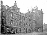
St Leonard's District Photos Photo 5 Simon Square See reply below |
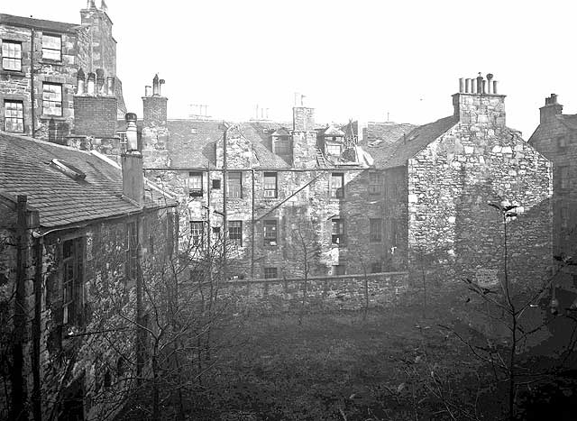
© Reproduced with acknowledgement to David Gordon, Old Town, Edinburgh
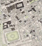
showing where the photograph above was taken from
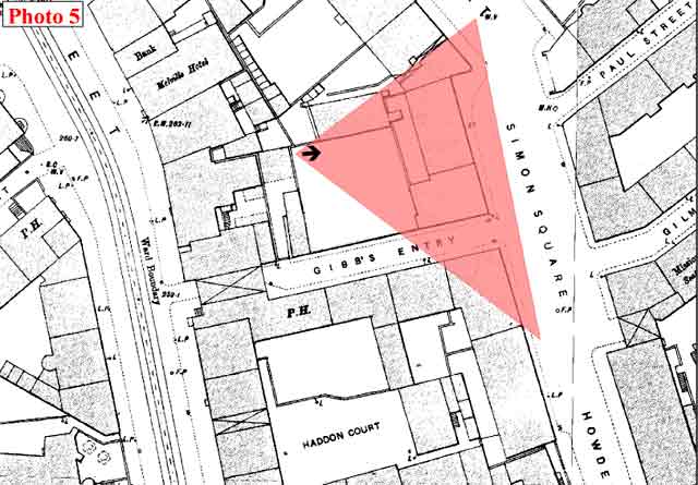
© This annotated Ordnance Survey 1:500 Town Plan of 1894 is reproduced with acknowledgement to Neil Lawrence. See 'Reply 2' below.
|
St Leonard's District - 1920s |
|
Collection of Photos The image above is taken from a collection of whole-plate negatives. The photos were probably taken around the 1920s. If you recognise this street, please email me. Thank you. Peter Stubbs: July 4, 2008 |
|
Reply 1. John Hadden Edinburgh |
|
Thank you to John Hadden, Edinburgh, who wrote: |
|
Simon Square "I think that the view in Photo 5 is the back of the block of buildings seen in Photo 21. Along the front of the block in Photo 21 can be seen a single chimney pot and then 2 groups of 4 chimney pots to the right. On Photo 5, we can see the faint outline of the chimneys on the other side of the block and there are 2 groups of 4 chimney pots at the left and a single pot further to the right. The tall block on the left of Photo 5 is at an angle to the lower main block. This is similar to what happens at the change of direction at the meeting point of Davie Street and Simon Square. The gap at the far right of Photo 5 would therefore be Gibb's Entry. John Hadden, Edinburgh: July 11, 2008 |
|
Reply 2. Neil Lawrence Fountainbridge, Edinburgh |
|
Thank you to Neil Lawrence for annotating a copy of his 1:500 Ordnance Survey Town Plan of Edinburgh, 1894, to show where the photograph above would have been taken from. Neil's annotated map is reproduced below the photograph at the top of this page. Acknowledgement: Neil Lawrence, Fountainbridge, Edinburgh: July 15, 2008. |
|
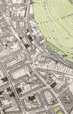
1891 Map Simon Square can be found on the South Side map below, on the right-hand side of the map, about 2/3 of the way down the map. |
|
More photos - Questions and Answers: Where is it? |
||