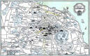
Pictorial Map of Edinburghshowing the premises of Bruce Peebles |
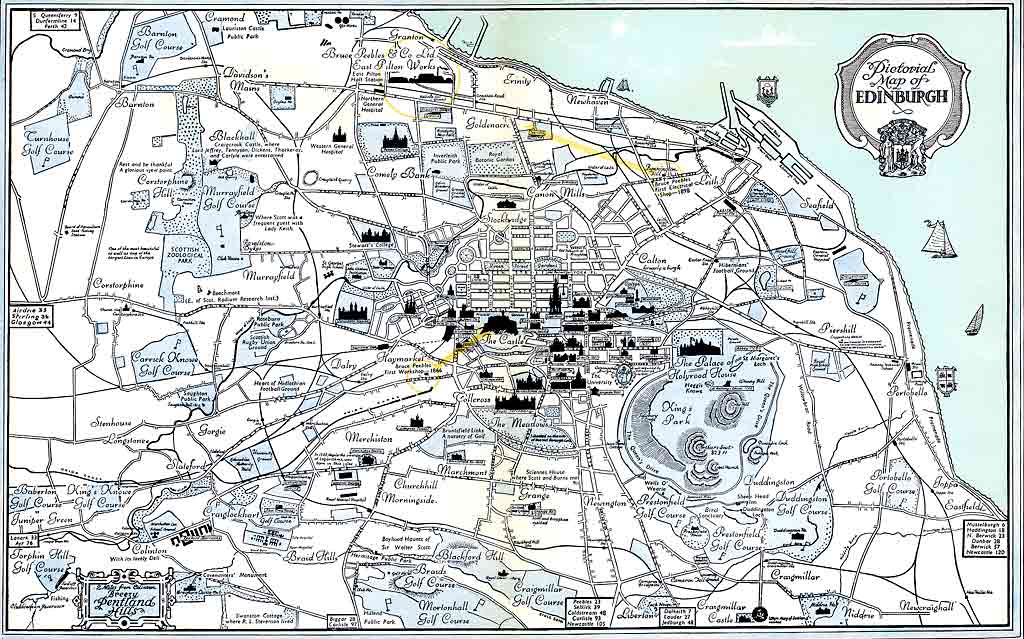
© Reproduced with acknowledgement to Siemens Transmission & Distribution Ltd
|
Pictorial Map of Edinburgh - 1954 |
|
Here is a pictorial map of Edinburgh that appeared in as a two-page spread in 'The Story of Bruce Peebles, 1866-1954' Booklet No 104 (Publ. Bruce Peebles, 1955) This map shows roads, railways and some of Edinburgh's prominent buildings. The three premises used by Bruce Peebles between 1866 and 1954 all appear on the map, circled in yellow. |
|
Please scroll down to see other images from this map. |
|
Pictorial Map of Edinburgh - 1954 Published in 'The Story of Bruce Peebles, 1866-1954' |
|||
|
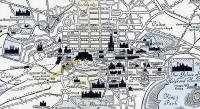
1. The whole map - Edinburgh showing Bruce Peebles works, 1866-1954 |
|||
|
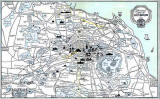
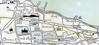
2. Zoom-in to North Edinburgh showing Bruce Peebles works, 1898-1954 |
|||
|
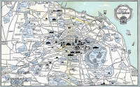
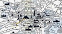
3. Zoom-in to Central Edinburgh showing Bruce Peebles works, 1866-1898 |
|||
|
Note - 1954 Map I have described this map as '1954', but it may, in fact be a little earlier. Holyrood Park on the map is named, 'King's Park'. The name of the park may well have changed to 'Queen's Park' in 1952 or 1953. |
|||