|
Edinburgh Section M 1844 - 1925 - 2001 |
|
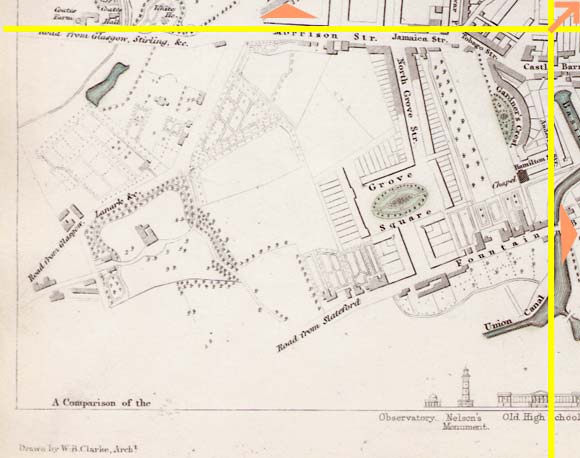
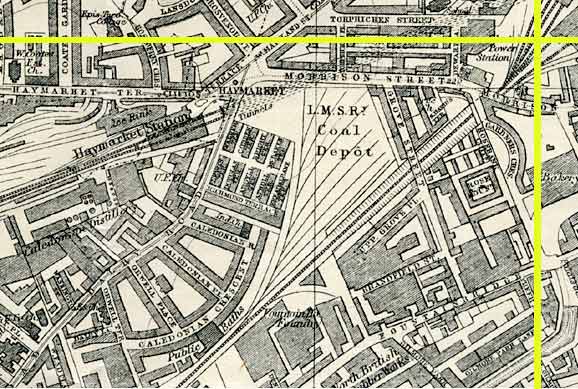
Haymarket |
|
Dalry |
1844 Map
|
|
|
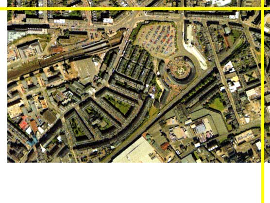
Map: Key No key Move: Left Right Up Down Aerial View 2001 |
1925 Map
|
|
© Peter Stubbs Please contact peter.stubbs@edinphoto.org.uk for permission to reproduce
|
|
© Copyright: XYZ Digital Map Company Limited. Click here for details of web site.
|
Haymarket |
|
Dalry |
|
This whole area has been developed (more than once) since the 1844 map was published. On the aerial view, we see the tenement housing of Dalry in the centre of the picture. Above this is new housing being built on the site of Caledonian Distillery. Caledonian distillery closed around 1990, leaving only one distillery now operating in Edinburgh - the North British Distillery, close to the Heart of Midlothian football ground. The old industrial area surrounding the Union Canal basin (lower right) is also now being developed. |
Other Sections

|
Maps of Edinburgh Today |
|
For maps of Edinburgh (and elsewhere in Britain) today, I suggest using the Multimap web pages. Please click here to open a window of the Multimap web site. The Multimap site can display maps to match post-codes, and also has links to web-cams in Edinburgh. |