|
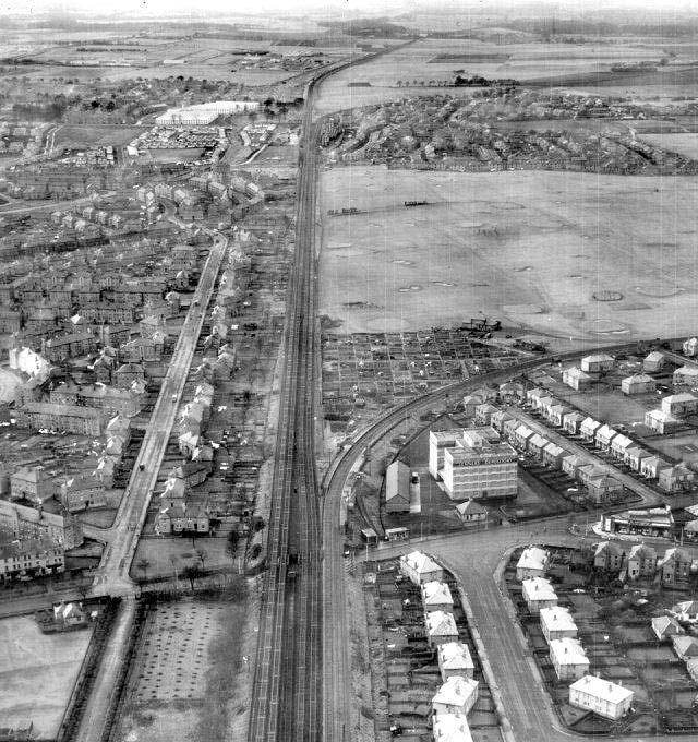
Carrick Knowe Golf Course Jenners Depository Baird Drive Aerial Photograph |
© Royal Commission on Ancient & Historical Monuments of Scotland (RCAHMS)
Item 764517. Collection: Joint Air Reconnaissance Intelligence Centre (Scotland Imagery). Ref. 58/RAF/813, Negative 0335 (PFFO)
|
Aerial Photo |
|
Carrick Knowe Golf Club This photo is an RAF oblique, aerial view taken from east of Carrick Knowe Golf Course, looking to the west, on December 7, 1951 |
|
Jenners Depository The large building in the centre of this photo was Jenners Depositary, a distinctive red-brick warehouse at 140 Balgreen Road, with imitation black+white astragal windows. There is a good view of the building, just to the north of the line, after passing Murrayfield Stadium, on a train journey from Edinburgh to Glasgow or the North of Scotland. It was built in 1925 and sold by Jenners around 80 years later. It is now used by Edinburgh Self Storage Co to provide the only heated self storage facility in Edinburgh. |
|
Baird Drive The street with the light houses near the bottom of this photo is Baird Drive, built in the late-1920s. It leads to the east (out of the bottom of this photo) towards Murrayfield Stadium. Baird Drive has been the
subject of a 'Baird
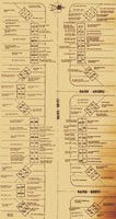
Drive Nostalgia Project'. The houses in Baird Drive in this photo, as we look at the photo are: - on the left (top to bottom): Even Nos, 2-48 - on the right (top to bottom): Odd Nos, 1-39 Here is a plan of Baird Drive, naming the residents who lived there around 1930. This was created as part of the 'Baird Drive Nostalgia Project'. Around 1930 |
|
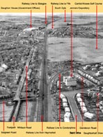
Key to Aerial View Please click on the thumbnail image below to see my key to this aerial view, identifying a few more landmarks on the photo: December 1951 |
|
Recollections 1 1. Ian Thomson Lake Maquarie, New South Wales, Australia |
|
Thank you to Ian Thomson who wrote: |
|
Carrick Knowe Golf Course "That's an excellent aerial pic of Carrick Knowe Golf Course. I would have been 17 when I lived near the course, close to the footbridge over to Stenhouse. The third green was tucked away in the top left, par 3. I used to slip over in late summer evenings with two clubs, pitcher and putter, for practice." |
|
Footbridge over the Railway "The footbridge was not built when I lived there. I seem to remember coming home from the dancing and crossing the main railway line in the early hours. If my memory is correct, a young girl was killed by a train crossing the main line in the 1940s, coming home from the dancing. It saved the long walk down to North Saughton Road. Our parents banned us from this short-cut. Eventually, the footbridge went up. |
|
Wartime During the war, in the 1940s: - the western side was our playground - the Home Guard was to the east. We were constantly hounded by the Greenie to get off the coarse, but considered it a challenge and fleet-footed our escape, often over the stank to the north, aided by a rope from a tree." |
|
South Gyle Farm In this pic. to the west of Broomfield was South Gyle Farm. I remember, clearly, working as a plumber there late at night in freezing conditions, with blowlamps, trying to get the water through the lead pipes. Just to the left, you can see the farm workers' cottages on the road passing under the railway up to Sighthill. |
|
Ian Thomson, Lake Maquarie, New South Wales, Australia: December 14, 2010 |


