|
Craigmillar Old Aerial Photos Breweries, Roads and Railways |
|
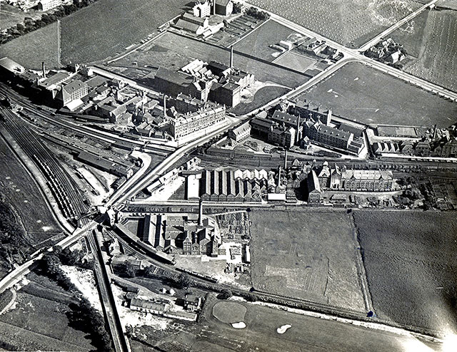
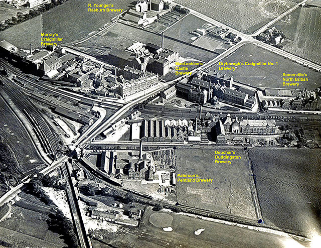
This view looks to the east from above Prestonfield Golf Course. The roads at the crossroads in this photo are: - LEADING TO TOP CENTRE: Niddrie Mains Road - LEADING TO TOP- RIGHT CORNER: Craigmillar Castle Road - LEADING TO RIGHT SIDE: Peffermill Road - LEADING TO BOTTOM-LEFT CORNER: Duddingston Road West |
© Reproduced with acknowledgement to Paul Sutherland, Glasgow, Scotland
|
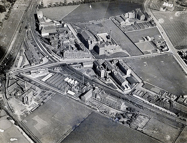
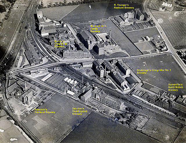
This view looks to the NE from above Prestonfield House. The roads at the crossroads in this photo are: - LEADING TO TOP: Niddrie Mains Road - LEADING TO RIGHT: Craigmillar Castle Road - LEADING TO RIGHT SIDE: Peffermill Road - LEADING TO LEFT: Duddingston Road West |
© Reproduced with acknowledgement to Paul Sutherland, Glasgow, ScotlandPhoto
|
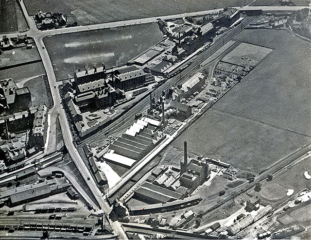
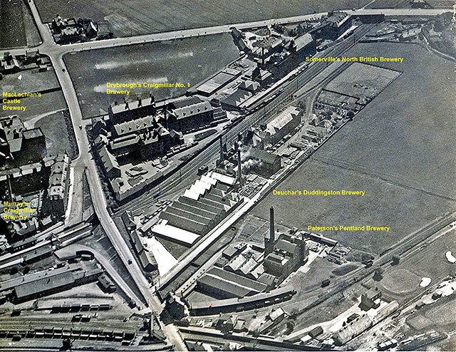
This view looks to the north from above Duddingston Church and Loch. The roads at the crossroads in this photo are: - LEADING TO LEFT: Niddrie Mains Road - LEADING TO TOP: Craigmillar Castle Road - LEADING TO RIGHT: Peffermill Road - LEADING TO BOTTOM: Duddingston Road West |
© Reproduced with acknowledgement to Paul Sutherland, Glasgow, Scotland
|
Comment 1. Paul Sutherland Glasgow, Scotland |
|
Thank you to Paul Sutherland for allowing me to reproduce these photos from his collection. |
|
Paul wrote: Aerial Photos "Browsing through an old file of pictures, I came across these three aerial views of the breweries at Craigmillar, taken obviously before the building of the 'dreaded scheme' **. 'The Innocent Railway can be seen running through one of these photos." **i.e. The Craigmillar housing scheme. Paul Sutherland, Glasgow, Scotland: September 5, 2013 |
|
The Scheme Here is a photo of part of Craigmillar Estate which Paul refers to above as the 'dreaded scheme'. The building of this estate began around 1930. This photo is one of a series that I took in 2007, as the houses were about to be demolished. |
|
Paul added: Aerial Photos "These photos appear to be 1930s era. *** I believe that they would have been taken for one of the brewery companies because on the back of one of them there are boundary markings, marking out an empty field beside the Robert Deuchar building. On the back of another, there are street names in pencil." Paul Sutherland, Glasgow, Scotland: September 15, 2013 *** In fact, the three aerial photos above may have been taken a little earlier than 1930s. I believe that the building of houses on the Craigmillar estate began around 1930. Peter Stubbs, Edinburgh: September 18, 2013 |
|
Comment 2. Andy Arthur Meadowbank, Edinburgh |
|
|
Breweries Thank you to Andy Arthur for taking the time to add captions to the three aerial photos above. That's very helpful. I appreciate that. I've now added the photos with Andy's annotations below, and have numbered them: Photos 4, Photo 5 and Photo 6. Acknowledgement: Andy Arthur, Meadowbank, Edinburgh: September 21, 2013 |
|
|
Enlarge these Photos To enlarge these photos and read the brewery names more easily, please click on one of these links:
|
© Reproduced with acknowledgement to Paul Sutherland, Glasgow, Scotland and to Andy Arthur who added the captions
© Reproduced with acknowledgement to Paul Sutherland, Glasgow, Scotland and to Andy Arthur who added the captions
© Reproduced with acknowledgement to Paul Sutherland, Glasgow, Scotland and to Andy Arthur who added the captions
