|
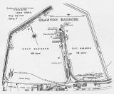
One of the Plans for Granton Harbour 1937 |

© Reproduced with acknowledgement to Buccleuch Estates and to Argyll Publishing
|
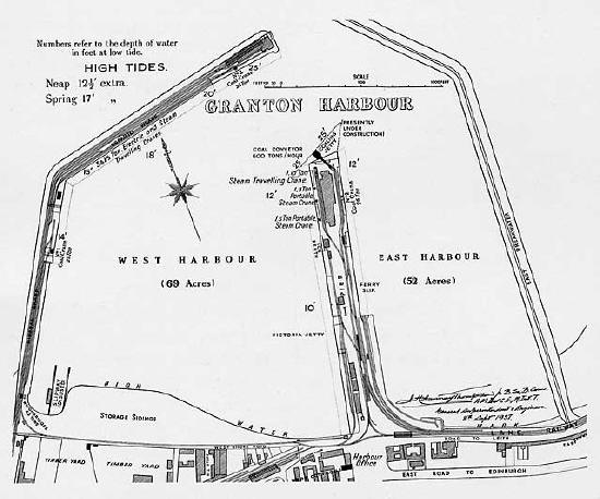
Map of Granton Harbour 1937 |
|
Centenary This map shows Granton Harbour in 1937, a hundred years after work on building the harbour commenced. The Act of Parliament to build Granton Harbour received Royal Assent from King William IV on April 21, 1837. The first part of the harbour, Middle Pier, opened on Queen Victoria's Coronation Day, June 28, 1838. Queen Victoria visited the harbour on September 1, 1842. This map shows slipways, names jetties and wharfs shows the position of the railway lines and gives details of the cranes in use in the harbour. |
|
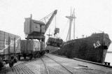
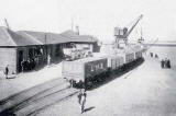
Granton Harbour Coaling Berth Here are a couple of photos of the Coaling Berth at Granton Harbour in the 1930s: |
|
Today The Eastern Harbour is still in use, mainly by pleasure craft. Most of the Western Harbour was reclaimed, in stages, during the 20th century and early-21st century. The reclaimed land is now, in 2006, being redeveloped as housing. |
|
Granton Harbour Recollections Alex Dow |
|
Thank you to Alex Dow, Fife, Scotland, who wrote: "I've just come across the 1937 Plan for Granton Harbour."
Coal Conveyor "I note that the Coal Conveyor that I described, is just being built. The railway track was extended on to the "new" ground, turning slightly rightwards, to get better runs down in to the dip and up to the buffers on the stub end. I don't remember the Coaling Crane on the right side of the tracks, probably scrapped after the introduction of the new system." Ice Factory "The Ice Factory is exactly where I remember it, at the "Ice Berth". Harbour Railway Station "The Harbour Railway station is the upper long black rectangle on the right of the track from the triangle of track at the land entrance, where the cross-over from the Ice Factory comes in. The station track is the nearer section on the right of the platform, the other track above was separated by a wall from the station." Ferry Slip "The Ferry Slip was for the first train ferry ever, over to Burntisland; but disused from shortly after the opening of the Forth Bridge in 1890. The London coastal steamers and the Northern Lighthouse Board boats generally tied up alongside slightly seawards of Ferry Slip". Caledonian and NB Railways "The horizontal part of the railway triangle was the only straight-through connection between the Caledonian Railway serving the west and Glasgow; and the North British Railway serving the east and Edinburgh!" |
|
Alex also provided details of other links between the Caledonian and North British railway lines in Edinburgh - using private sidings at Haymarket and using the Suburban Line |
|
Alex Dow, Fife, Scotland: December 9, 2006 |
|
MAPS: Full index |
|
MAPS: Short Index with thumbnails |