|
Maps and Aerial Views |
|||||||||||||||||
|
Please scroll down OR select the shorter index with thumbnail maps . Large maps may take a long time to load, but the wait may be worthwhile. |
|||||||||||||||||
|
Edinburgh - Early Maps |
Edinburgh - Aerial Views |
||||||||||||||||
|
Edinburgh Districts - 1844 map + 1925 map + 2001 aerial view |
|||||||||||||||||
|
Edinburgh Districts 1947 Aerial Views
|
|||||||||||||||||
|
Edinburgh Districts 2001 Aerial Views
|
|||||||||||||||||
|
Edinburgh Pictorial Map |
|||||||||||||||||
|
Edinburgh - 1870 SMALL: - Leith |
Edinburgh - 1870 LARGE:
- Leith |
||||||||||||||||
|
Edinburgh - 1870 Extracts from large-scale maps |
|||||||||||||||||
|
- Leith |
Edinburgh - 1915 LARGE:
- Leith |
||||||||||||||||
|
- Granton - Leith - Liberton - Niddrie - Zoom-out |
Edinburgh - 1925 LARGE:
- Granton - Leith - Liberton - Niddrie - Zoom-out |
||||||||||||||||
|
- Redford |
Edinburgh - 19 12 LARGE: - Redford |
||||||||||||||||
|
Edinburgh - 19 30 |
|||||||||||||||||
|
- Leith - Liberton - Redford |
Edinburgh - 1940 LARGE: - Craigmillar + Niddrie - housing - Leith - Liberton - Redford |
||||||||||||||||
|
Edinburgh - 19 48 SMALL: |
Edinburgh - 19 48 LARGE: |
||||||||||||||||
|
Edinburgh - 19 50s SMALL : |
Edinburgh - 19 50s LARGE: |
||||||||||||||||
|
Edinburgh - late-1940s - Calder - streets of pre-fab houses
|
|||||||||||||||||
|
Edinburgh - early-1950s |
|||||||||||||||||
|
Edinburgh - 1955 SMALL: - Colinton - Leith - Liberton - Niddrie |
Edinburgh - 1955 LARGE:
- Colinton - Granton - Leith - Liberton - Niddrie |
||||||||||||||||
|
Edinburgh - C hronological Map |
|||||||||||||||||
|
Edinburgh - Central 2001 Photo 2001 zoom-out 2001 zoom-in |
Edinburgh - Princes Street
Princes
Street Studios:
1850 1855
|
||||||||||||||||
|
Edinburgh New Town - Kirkwood map - 1819 |
|||||||||||||||||
|
Edinburgh - Old Town - 1891
|
|||||||||||||||||
|
Edinburgh - Old Town 1940 Cowgate School, Church, Water Tank c. 1950 Cowgate Schools and Church |
Edinburgh - Royal Mile 1979 1979 Num. Key 1979 Alpha. Key
|
||||||||||||||||
|
Edinburgh - Castle to Calton Hill |
Edinburgh - Dumbiedykes |
||||||||||||||||
|
Edinburgh - Tanfield |
Edinburgh - Ravelston Dykes Road |
||||||||||||||||
|
Edinburgh - Lauriston Castle |
Edinburgh - Waverley |
||||||||||||||||
|
Edinburgh - Lawnmarket |
Edinburgh - Time Gun |
||||||||||||||||
|
Edinburgh - Housing Hutments built 1920-21 |
Edinburgh - Royal Botanic Garden |
||||||||||||||||
|
Edinburgh - Railways |
Edinburgh - Trams & Buses 1920 North Edinburgh and Leith |
||||||||||||||||
|
Edinburgh - Railways and Trams Railways + Trams - 1924 - Edinburgh |
|||||||||||||||||
|
Edinburgh - Airport 1923 |
|||||||||||||||||
|
Edinburgh and Leith |
Edin
and
Leith
|
||||||||||||||||
|
Firth of Forth |
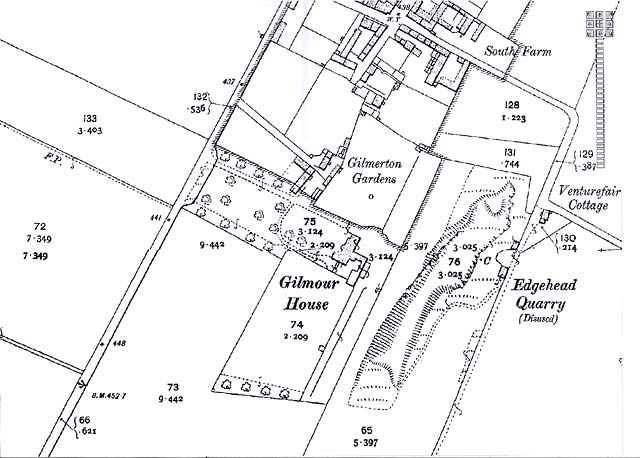
Gilmerton House |
||||||||||||||||
|
Granton Harbour |
Newhaven |
||||||||||||||||
|
Granton: United Wire Works |
Newhaven aerial view |
||||||||||||||||
|
Newington: Echo Bank 1852 |
|||||||||||||||||
|
Leith |
Edinburgh Waterfront |
||||||||||||||||
|
East Thomas Street |
|||||||||||||||||
|
Portobello |
Around Edinburgh 1884 Queensferry to Musselburgh |
||||||||||||||||
|
Edinburgh - Whole City |
Edinburgh - Whole City with proposed tram line, 2010 |
||||||||||||||||
|
Edinburgh Forthside |
Outline Maps |
||||||||||||||||
|
Scotland 1794 1794 zoom-in 1794 zoom-in-more 1806 zoom-in 1806 zoom-in LARGE 1806 zoom-in more 1806 zoom-in-more LARGE |
Britain and Ireland |
||||||||||||||||
|
Europe |
World |
||||||||||||||||
|
Google Earth and other aerial views |
|||||||||||||||||
|
Maps on Postcards - Recent |
Maps on Postcards - 1725 |
||||||||||||||||
|
PLEASE NOTE: |
|
1. Some maps may be SLOW to LOAD, especially the larger maps. 2. I have assumed that most viewers will be prepared to wait a little longer to see a better quality image, rather than see a poor quality quickly. I hope you find the wait worthwhile. Once a large map appears, you should be able to scroll across it and up and down, using the scroll bars. Peter Stubbs |

|
Maps Other web sites |
|
Edinburgh Today For maps of Edinburgh and elsewhere in Britain to day, I recommend Multimap . The Multimap site displays maps for post-code s, and has Edinburgh web-cams . |
|
Edinburgh Yesterday For old maps of Edinburgh and elsewhere I recommend the NLS map site . This site can display many maps from the National Library of Scotland's collection. |
|
Edinburgh Today and Yesterday For old maps, new maps and aerial views of Edinburgh and elsewhere I recommend th is Old Maps web site. Maps on this site can be found by searching for by searching for place names, addresses or co-ordinates |
|
Granton History Group For the following interactive tram route maps and references to other sources of information . |