|
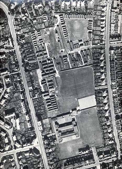
Aerial Photograph Wardie School Playing Fields 1947 |
|
Wardie School and its grounds lie between Granton Road and Netherby Road in the Trinity district of Edinburgh, about three miles to the north of the City Centre. The school opened in 1931. The the time this aerial view was taken, in 1947, shortly after the end of the 2nd World War, the northern part of the school grounds housed the temporary accommodation of Lochinvar Royal Navy Camp. |
|
Wardie School Grounds - 1947
© Reproduced courtesy of RCAHMS |
|
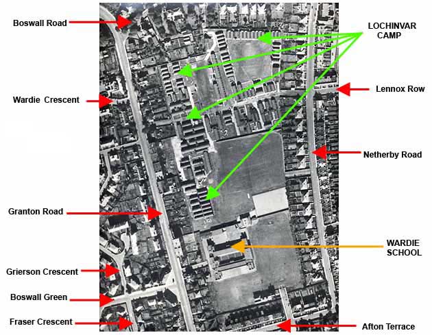
Key to the aerial view of North-west Trinity - 1947
© The aerial photograph to which this key has been added is reproduced courtesy of RCAHMS |
|
Recollections - Wardie School - 1930s to 1980s |
|
MAPS: Full index |
|
MAPS: Short Index with thumbnails |