|
Edinburgh Section B 1844 - 1925 - 2001 |
|
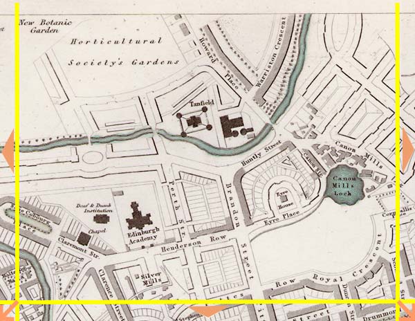
Canonmills |
1844 Map
|
|
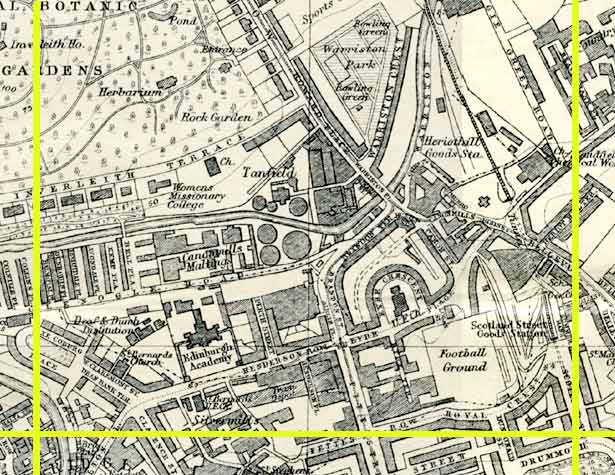
1925 Map
|
|
© Peter Stubbs Please contact peter.stubbs@edinphoto.org.uk for permission to reproduce
|
|
© Copyright: XYZ Digital Map Company Limited. Click here for details of web site.
|
Canonmills |
|
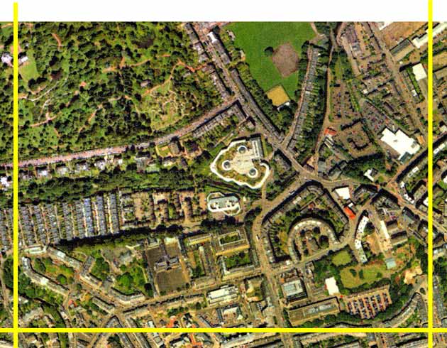
The course of the Water of Leith can be seen running from the western side of the 1844 map to the northern side. It follows the line of trees in the aerial view. The prominent features in the centre of the 1844 map are the gasworks at Canonmills, and Tanfield Hall, where the Ministers of the Free Church of Scotland held their First Assembly in 1843, following their separation from the Free Church of Scotland, as recorded in DO Hill's Disruption painting. This has been replaced in the aerial view by the Tanfield Administrative Offices of The Standard Life Assurance Company, with the three domes and rooftop garden. This office was opened in 1991. Canonmills loch has now been drained. In the top left corner of the 1844 map is the Horticultural Society Gardens, now the Royal Botanic Gardens. |
Other Sections

|
Maps of Edinburgh Today |
|
For maps of Edinburgh (and elsewhere in Britain) today, I suggest using the Multimap web pages. Please click here to open a window of the Multimap web site. The Multimap site can display maps to match post-codes, and also has links to web-cams in Edinburgh. |