|
Edinburgh Section A 1844 - 1925 - 2001 |
|
Inverleith Park |
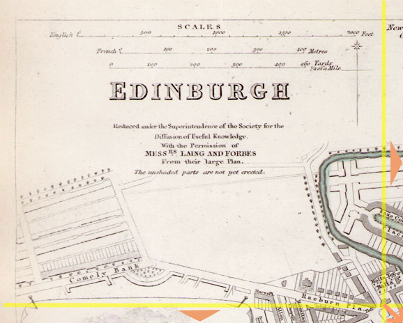
1844 Map
|
|
|
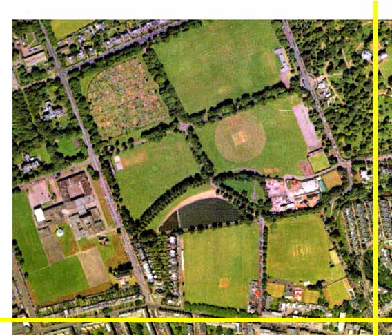
Whole Map: Key No key Move: Left Right Up Down Aerial View 2001 |
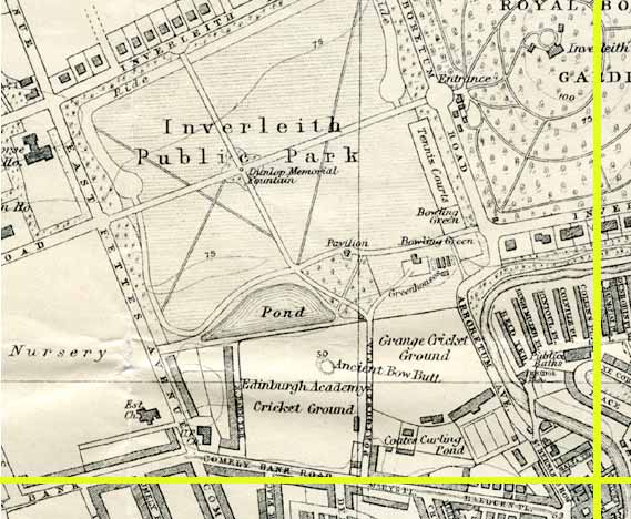
1925 Map
|
|
© Peter Stubbs Please contact peter.stubbs@edinphoto.org.uk for permission to reproduce
|
|
© Copyright: XYZ Digital Map Company Limited. Click here for details of web site.
|
Inverleith Park |
|
Along the bottom of these maps and the aerial view is Comely Bank road, running to through Comely Bank (bottom left) towards Stockbridge (bottom right) and on to the centre of Edinburgh. Beneath the legend on the 1844 map is the south west corner of Inverleith Park. This can be seen on the aerial view above, with its allotments (upper left) and boating lake (lower centre). Sailing of model boats on the pond in Inverleith Park has been a popular activity for many decades. The President of Edinburgh Model Boat Club tells me that his members still sail on the pond 'as long as the water is liquid' and that model yacht clubs also still sail on the pond [Dec 2004] |
Other Sections

|
Maps of Edinburgh Today |
|
For maps of Edinburgh (and elsewhere in Britain) today, I suggest using the Multimap web pages. Please click here to open a window of the Multimap web site. The Multimap site can display maps to match post-codes, and also has links to web-cams in Edinburgh. |