|
Edinburgh Section D 1844 - 1925 - 2001 |
|
Pilrig |
1844 Map
|
|
|
Whole Map: Key No key Move: Left Right Up Down Aerial View 2001 |
1925 Map
|
|
© Peter Stubbs Please contact peter.stubbs@edinphoto.org.uk for permission to reproduce
|
|
© Copyright: XYZ Digital Map Company Limited. Click here for details of web site.
|
Pilrig |
|
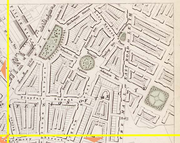
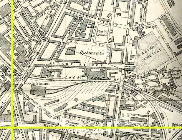
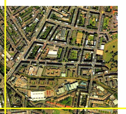
The top part of these maps is Leith; the bottom is Edinburgh. The boundary (before Leith became part of Edinburgh) ran through the the base of the 'V' shaped junction (upper left) where Pilrig Street joins Leith Walk. The road leading down the right hand side of this picture from Leith to Edinburgh is Easter Road. Its name on the 1844 map is 'The Mall or East Road to Leith'. Easter Road football stadium, the home of Hibernian Football Club is just off this map to the right, beyond Eastern Cemetery, the green area with trees at the right hand side of the aerial view above. The two squares and Heriot Crescent, shown in the 1844 map were not in fact built. |
Other Sections

|
Maps of Edinburgh Today |
|
For maps of Edinburgh (and elsewhere in Britain) today, I suggest using the Multimap web pages. Please click here to open a window of the Multimap web site. The Multimap site can display maps to match post-codes, and also has links to web-cams in Edinburgh. |