Britain and Ireland

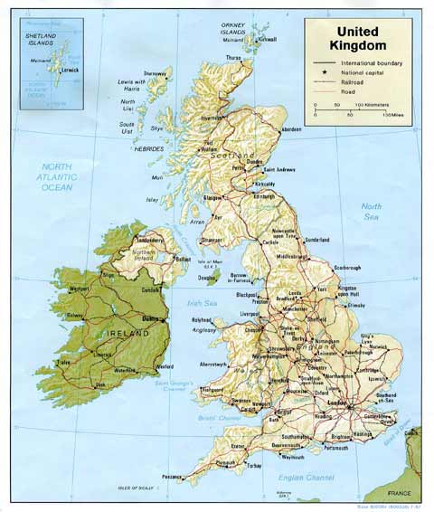
Shaded Relief Map - 1987

Shaded Relief Map of the British Isles  -  1987


   Enlarge this map  Enlarge this map *

Zoom-in  to Scotland (c.1830)

Zoom-out  to Europe (2001)


Maps of British Isles:     1844       1877       1987       1987 (large)*      Outline

*  This is a large map that may be slow to load


MAPS:  Full index

Outline Map of the British Isles © MAPS: Short Index with thumbnails


If you are looking for LARGE SCALE maps of BRITAIN, I recommend  Multimap web site.


The map above is reproduced with acknowledgement to the Perry-Castañeda
 
Map Collection
at the Library of the Library of the University of Texas in Austin


MAPS:  Full index

Outline Map of the British Isles © MAPS: Short Index with thumbnails


__________________