Maps with links to

 Engravings and Photographs


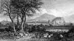
Engravings of Thomas H Shepherd drawings

Published in 'Modern Athens'  -  1829
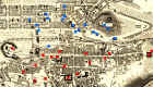
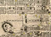
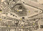
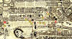
Central Edinburgh

    Map with links to Engravings from Modern Athens, published 1829 ©

View from Craigleith

    Engraving in 'Modern Athens'  -  with links to other engravings ©


Photographs by Thomas Vernon Begbie

Late 1850s

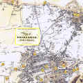
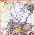
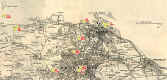
A

Edinburgh & Leith

with links to Begbie photos

Edinburgh and Leith  -  Begbie Photos ©

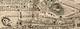
B

Central Edinburgh,  west

with links to Begbie photos

Central Edinburgn, west  -  Begbie Photos ©

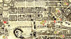
C

Central Edinburgh, east

with links to Begbie photos

Central Edinburgh east  -  Begbie Photos ©

Edinburgh & Leith

Key to other maps

    Edinburgh and Leith  -  Key to maps linking to Begbie's photos of the 1850s. ©

Central Edinburgh - west and east

Showing the area covered 
by 'west' and 'east' maps,
B and C above.

There are no links to pictures from this map

    Central Edinburgh  -  west and east  -  Area covered by some of Begbie's photos ©


Photographs from the Evening News Collection

1950s

Central Edinburgh

Map of Central Edinburgh - linked to photographs from the Evening News Collection, taken in the 1950s ©


My Photographs

Around 2000

Central Edinburgh

Map of Central Edinburgh - with links to my photographs taken around 2000 ©

Cramond to Portobello

Map from Cramond to Portobello - with links to my photographs taken around 2000 ©


Maps for Begbie photos

Central Edin - West    Central Edin - East    Edinburgh & Leith

Maps for photos:

1850s       1950s      2000 Central Edinburgh       2000 Around Edinburgh

Maps for engravings:

1829

Photographs

Around Edinburgh


MAPS:  Full index

Outline Map of the British Isles © MAPS: Short Index with thumbnails


__________________