Central Edinburgh
Early 1700s
|
|
© Copyright: For permission to reproduce, please contact peter.stubbs@edinphoto.org.uk
|
earlier
map
later
map
zoom-out
move right (east)
|
|
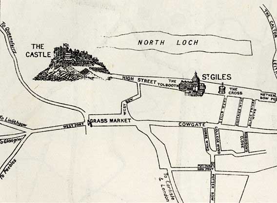
1700s This for many centuries was the approximate size of the old City of Edinburgh. Everything to the east was in the Borough of Canongate. The City Wall crossed the Royal Mile at the Netherbow, at the right hand border of the map above. |
|
MAPS: Full index |
|
MAPS: Short Index with thumbnails |