|
|
© Copyright: For permission to reproduce, please contact peter.stubbs@edinphoto.org.uk
|
|
|
Early 1700s |
|
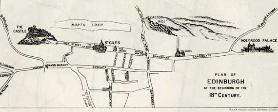
This map by W&AK Johnston was published in 1910 by TS Muck, Geography Teacher in the Royal High School, in his book: Edinburgh and District - An Introduction to Geography It shows a very compact city that had not yet spread to the north beyond the North Loch (now drained and planted as Princes Street Gardens. |
|
MAPS: Full index |
|
MAPS: Short Index with thumbnails |