Edinburgh
2001
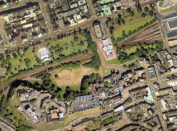
The
aerial photo above includes:
TOP
LEFT: The formal lay-out of straight streets
forms the first part of the Edinburgh New Town to be built, in the
1760s. Running approximately west to east are:
-
Queen Street Gardens at the top of the photo; then Queen Street, where Edinburgh Photographic Society held most of its
Popular
Meetings in the 19th century. The National Galleries' Scottish
Photographic Collection is also housed on Queen Street, in the National
Portrait Gallery.
-
Princes
Street, home to many of Edinburgh's early photographers (with
Princes Street Gardens and the galleries above)
-
George Street, home to many of the early meetings of the
Photographic
Society of Scotland and Edinburgh Photographic
Society. George
Street links the two squares, St Andrew Square (right) and Charlotte Square
(left -
out of photo)
RIGHT:
Running diagonally down the right hand side and out of the photo at the
bottom right corner is 'The Bridges'. This starts as North Bridge
at the Balmoral Hotel at the East End of Princes Street. Then
after crossing the Royal Mile at the Tron Church, it becomes South
Bridge.
WITHIN
THE WHITE BOX: Princes Street Gardens run diagonally across
this area. The light circle in West Princes Street Gardens is the
open air stage.
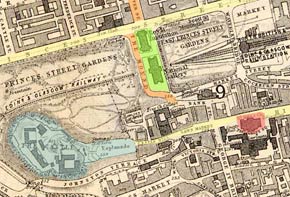
The
roads that can be seen in this area match those shown on the map of 1870
- despite the 131-year gap between the two images.
 ©
©
Hanover Street, Princes Street, The Mound, George IV Bridge,
Victoria Street, the Royal Mile, and other roads can all be clearly
recognised on both images. More
pages: National
Galleries
|