Central Edinburgh

Edinburgh Castle  -  National Galleries  -  St Giles Church

1917

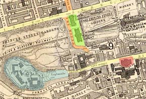
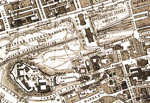
This map by James Bartholemew appeared in the Post Office Directory, 1917-18.

Central Edinburgh  -  The National Galleries and Edinburgh Castle  -  1917 map

earlier map         later map        zoom-in          zoom-out

1830       1840        1850        1860        1870        1917        2001    all (slow)    thumbnails

©    For permission to reproduce, please contact peter.stubbs@edinphoto.org.uk


Central Edinburgh  -  Key

Edinburgh Castle  -  National Galleries  -  St Giles Church

NOTE:  This key is based on the 1870 map

YELLOW = Princes St and the Royal Mile

     ORANGE= Hanover St and the Mound

GREEN = National Galleries

BLUE = Edinburgh Castle

RED = St Giles Church

©  Copyright: For permission to reproduce, please contact peter.stubbs@edinphoto.org.uk


This 1917 map shows that there has been very little change
 in the roads, railways,  buildings and gardens since the map of
1870.

More pages:  National Galleries


MAPS:  Full index

Outline Map of the British Isles © MAPS: Short Index with thumbnails


__________________