2001
|
|
earlier map later map zoom-out zoom-in |
© Copyright: XYZ Digital Map Company Limited. Click here for details of web site.
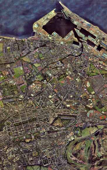
This
aerial view is detail taken from a photo by
XYZ Digital Map Company Limited.
Edinburgh & Leith 2001 Above is an aerial photo covering the same area as the maps of 1835, 1840, 1860, 1870 and 1917. The expansion of both Edinburgh and Leith over this period can be seen, as can the expansion of Leith Docks as far west as the little harbour at Newhaven. |
|
MAPS: Full index |
|
MAPS: Short Index with thumbnails |