|
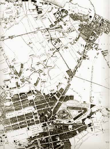
1835 This map appeared in the Letter Carriers Directory, 1835-36
© Reproduced by courtesy of Edinburgh City Libraries and Information Services |
|
BOTTOM OF MAP: Edinburgh TOP RIGHT CORNER: Leith This map shows how distinct the communities of Edinburgh and Leith were in the 1835. There were few buildings along the route from Edinburgh to Leith, and even fewer in the fields surrounding this road. The boundary between Leith and Edinburgh is the zig-zag line from upper-left to centre-right on the map. |
|
MAPS: Full index |
|
MAPS: Short Index with thumbnails |