|
Edinburgh 1925 |
Map
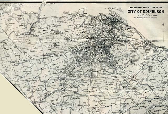
showing the full extent of the City of Edinburgh, 1925-26,
by John Bartholomew & Son Ltd.
© For
permission to reproduce please contact peter.stubbs@edinphoto.org.uk
|
Edinburgh - 1925 |
|
The map above "showing the full extent of the city of Edinburgh" was published by John Bartholemew & Son in 1925. It was inset into the top right-hand corner of a large map of the central part of Edinburgh. Please select another map from below but note: The larger the map:
- the more detail can be seen on it, Once a map has loaded, you can use the scroll bars to scroll across and up and down the map. |
|
Add the proposed tramlines to this map. As proposed at |
|

|
Maps: All Edinburgh Districts: 1870 1915 1925 1940 1955 2001 |
|
|
Map Index: Full Index |
Map Index: Short Index + thumbnails |