|
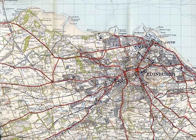
Edinburgh 1923 |
Extract from Ordnance Survey One Inch Map No 74 © For permission to reproduce please contact peter.stubbs@edinphoto.org.uk
|
Edinburgh 1923 |
|
This is the top-left corner taken from Ordnance Survey 'Popular One-Inch Series' of maps, sheet 74: Edinburgh. This map was published in 1925: "Revision Full 1923 with later corrections". When this map was published, Edinburgh extended as far west as Cramond Island (upper centre-left). Now, in 2006, the boundary extends as far west as Queensferry (top left corner). |
|
Maps: All Edinburgh Districts: 1870 1915 1925 1940 1955 2001 |
|
|
Map Index: Full Index |
Map Index: Short Index + thumbnails |


