|
Edinburgh Waterfront Land beside the Firth of Forth near Granton being developed over the period 2002 to 2020 |
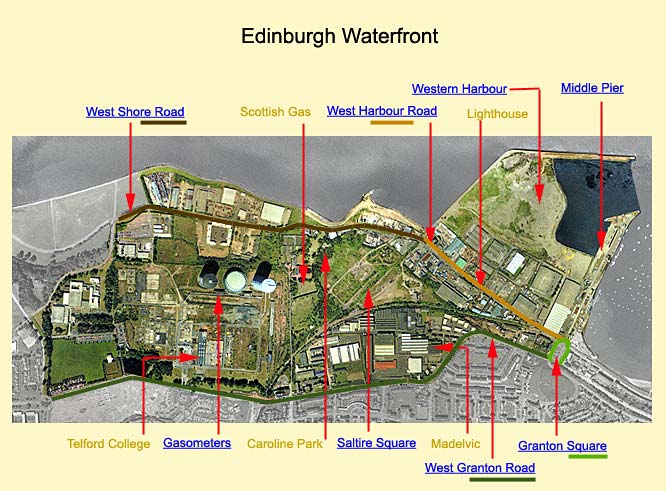
Map with links to Photos
Please click on a location on this map to see thumbnail images.
Based on an aerial photo by XYZ: © Copyright: XYZ Digital Map Company Limited. Click here for details of web site.
Roads surrounding Edinburgh Waterfront - and Gypsy Brae
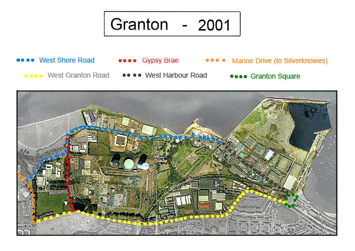
© Copyright: XYZ Digital Map Company Limited. Click here for details of web site.
Edinburgh Waterfront and surrounding area - zoom-out
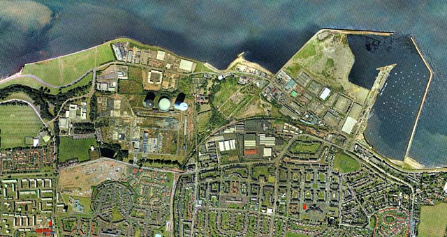
© Copyright: XYZ Digital Map Company Limited. Click here for details of web site.
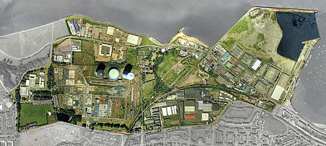
Edinburgh Waterfront and surrounding area - zoom-in

© Copyright: XYZ Digital Map Company Limited. Click here for details of web site.
Edinburgh Waterfront
© Copyright: XYZ Digital Map Company Limited. Click here for details of web site.
|
More photos around Granton |
Recollections |
|
|
Maps |
History and Questions |
Photos |