|
Leith - 1860 |
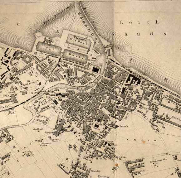
This map by W & AK Johnston appeared in the Letter Carriers' Directory, 1860-61.
© For permission to reproduce, please contact peter.stubbs@edinphoto.org.uk
|
Leith - 1860 |
|
1860: A pier has been built to separate the harbour into two parts. The first of several new docks, Victoria Wet Dock has been built. The first of several railways to arrive in Leith can be seen with its terminus between the two original docks. TODAY: All three docks on this map have now been filled in. The Scottish Office has been built where Victoria Dock is shown on this map. There are no longer any railway stations in Leith. |
| Leith |
|
Old Maps: 1693 1804 1835 1840 1860 1917 Small Maps: 1870 1915 1925 1940 1955 Large Maps: 1870 1915 1925 1940 1955 Aerial View: 2001 |
|
MAPS: Full index |
|
MAPS: Short Index with thumbnails |