|
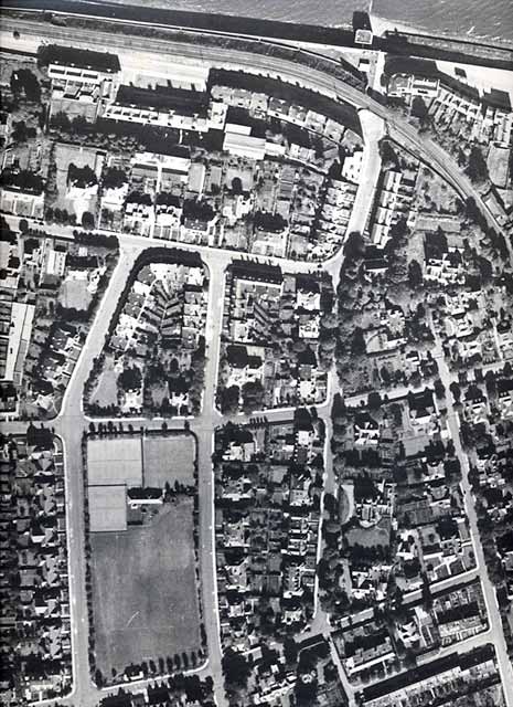
Aerial Photograph North-West Trinity 1947 |
|
The Firth of Forth runs along the northern part of this aerial view, with the old North British railway line crossing the bridge at Lower Granton Road. The railway track and bridge have now been removed. Lomond Park with its tennis courts and bowling green is in the lower-left corner of this view. |
|
North-west Trinity - 1947
© Reproduced courtesy of RCAHMS |
|
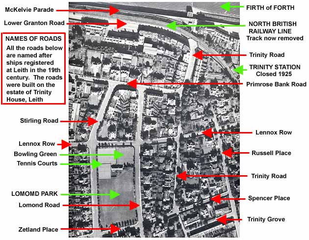
Key to the aerial view of north-west Trinity - 1947
© The aerial photograph to which this key has been added is reproduced courtesy of RCAHMS |
|
Recollections - Wardie School - 1930s to 1980s |
|
MAPS: Full index |
|
MAPS: Short Index with thumbnails |