|
Edinburgh Section L 1844 - 1925 - 2001 |
|
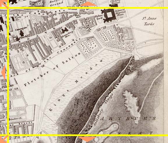
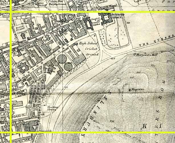
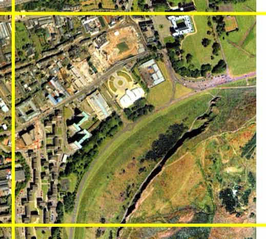
Holyrood Palace |
|
Queen's Park |
1844 Map
|
|
1925 Map
|
|
© Peter Stubbs Please contact peter.stubbs@edinphoto.org.uk for permission to reproduce
|
|
© Copyright: XYZ Digital Map Company Limited. Click here for details of web site.
|
Holyrood Palace |
|
Queen's Park |
|
The most prominent features in the picture above are: - Queen's Park and the lower slopes of Arthur's Seat (lower right). - Holyrood Palace (upper right) - Dynamic Earth - a Millenneum project. This has remained open. It provides an exhibition of the history of the earth (light building with circular area above - centre of picture). - Construction of the new Scottish Parliament building (upper centre). This area around the lower end of the Canongate at Holyrood once housed most of Edinburgh's breweries. |
|
The southern part of this area includes part of Dumbiedykes - old tenement buildings demolished around 1960. |
|
Dumbiedykes: Streets A-G Streets H-R Streets S-Z More Pages |
||
| Edinburgh Photos | Contributors | |
Other Sections

|
Maps of Edinburgh Today |
|
For maps of Edinburgh (and elsewhere in Britain) today, I suggest using the Multimap web pages. Please click here to open a window of the Multimap web site. The Multimap site can display maps to match post-codes, and also has links to web-cams in Edinburgh. |