|
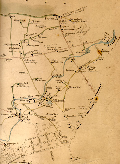
Roads within and connecting Cramond District Some of the road distances given on the map 1812 |
|
Below are a few examples of the road distances, as shown beneath the Map of Roads within and connecting Cramond District, surveyed by John Leslie & Son in 1812 The map gives the lengths of thirty different roads. Six of these appear in the example below. Distances are measured in roods and yards. 1 rood = 7 yards. The distances of 30 roads are listed. Here are six of the distances given: |
© Copyright: For permission to reproduce, please contact peter.stubbs@edinphoto.org.uk
|
MAPS: Full index |
|
MAPS: Short Index with thumbnails |