|
Edinburgh New Town Low Calton |
|
|
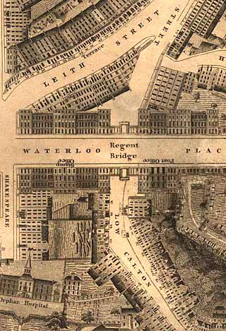
Kirkwood Map - 1819
©
Reproduced
by courtesy of the National Library of Scotland. |
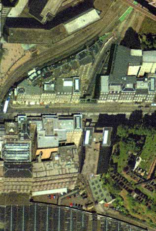
Aerial View - 2001
©
Copyright: XYZ Digital Map Company Limited. |
|
|
|
|
Low Calton |
|
|
This, at first sight, is a rather confusing section of the map. individual sections of buildings. Waterloo Place, the main road from the East End of Princes Street ot London, runs across the centre of the picture, crossing Regent Bridge over Low Calton. Just below the bridge on the right are part of the grounds of the Felons' Prison, situated beside the Bridewell in the Great London Road., an extension of Waterloo Place The Orphan's Hospital (Trinity Hospital) in Low Calton, in the lower-left corner of this map was demolished to make room for Waverley Station and the railway. |
|
|
Kirkwood Map - 1819 |