|
Edinburgh New Town Stockbridge |
|
|
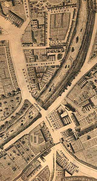
Kirkwood Map - 1819
©
Reproduced
by courtesy of the National Library of Scotland. |
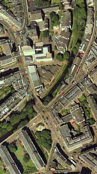
Aerial View - 2001
©
Copyright: XYZ Digital Map Company Limited. |
|
|
|
|
Stockbridge |
|
|
Stockbridge lies about a mile to the north of the West End of Princes Street Stockbridge is seen in a very rural setting in this map, with just a few houses scattered around the bridge. The bridge takes the road over the Water of Leith, the river that runs from the Pentland Hills to Leith. The whole area is now built up, but the road layout has hardly changed since this map was drawn: - The road from the bottom-right corner leads to Frederick Street in the centre of Edinburgh - The road from the right-hand side leads to Canonmills, also on the Water of Leith. - St Bernard's Row leads out of the top of the map towards Inverleith Park and the Royal Botanic Gardens |
|
|
Kirkwood Map - 1819 |