|
Edinburgh New Town Waverley |
|
|
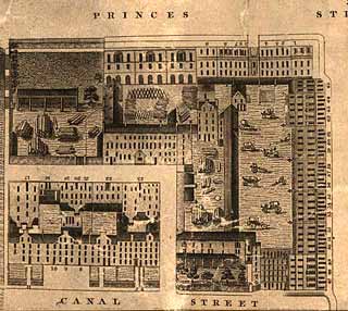
Kirkwood Map - 1819
©
Reproduced
by courtesy of the National Library of Scotland. |
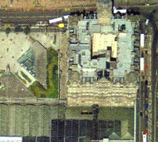
Aerial View - 2001
©
Copyright: XYZ Digital Map Company Limited. |
|
|
|
|
Waverley |
|
|
Now, nothing remains of this little corner of central Edinburgh at the corner of Princes Street and North Bridge. This aerial view is not too clear, but it shows what has replaced the old buildings. Three distinct sections can be seen: - UPPER RIGHT CORNER: North British Railway Hotel (now the Balmoral Hotel). - UPPER LEFT CORNER: The roof of part of the underground Waverley Market, now Princes Mall Shopping Centre with its Tourist Information Office above. - LOWER PART: The roof of Waverley Station. (There is now an entrance to Edinburgh Waverley Railway Station in about the position of Canal Street on the map.) |
|
|
Kirkwood Map - 1819 |