|
Dumbiedykes Road 'The Big Green' and 'The Plantations' |
© Reproduced with acknowledgement to Edinburgh City Libraries and Information Services
|
'The Big Green' and 'The Plantations' |
|
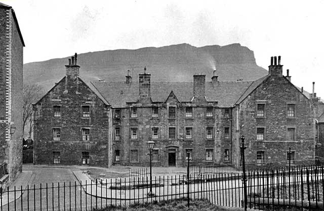
Housing This area was known as 'The Big Green'. It is seen here from the greens in front of 'The Balconies' housing in Dumbiedykes Road, with its old gas lamp on the pavement. On the extreme left of the picture, also on the east side of Dumbiedykes Road was the housing known as 'The Brickies' (made of bricks). Salisbury Crags in Holyrood Park can be seen in the background. |
|
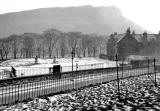
The Plantations The Plantations was an area of trees, just visible at the end of the road, between 'The Brickies' and 'The Big Green' on this photo. Jean Rae, who provided the photograph above, used to live in 'The Balconies' at no 34 Dumbiedykes Road. Jean Rae remembers running down Dumbiedykes Lane (the road that leads straight ahead in this picture - the road then turns left and goes to Holyrood Square - then dreeping over the wall into the plantations. Dreep = drip. i.e. Hold on to the top of the wall, lower yourself down then let go. The Plantations can be seen more clearly on this picture: |
|
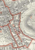
Map I believe that this part of Dumbiedykes Road was between its junctions with Waterston Avenue and Prospect Place, under the red border line at the NE corner of the St Leonard district shown on the map below. Please click on this map to enlarge it. It may be slow to load. |
|
Dumbiedykes: Streets A-G Streets H-R Streets S-Z More Pages |
||
| Edinburgh Photos | Contributors | |