|
Dumbiedykes Road |
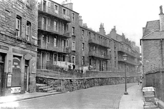
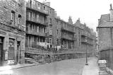
Looking down Dumbiedykes Road towards Holyrood
© Reproduced with acknowledgement to Edinburgh City Libraries and Information Services
|
Dumbiedykes Road |
|
Housing Here is a quiet view looking to the north down Dumbiedykes Road towards Holyrood. There are old gas lamps on the pavement and no traffic in the street, just a pram. The building behind the pram was the Social Work Nursery. Now, in 2006, it is Braidwood Community Centre. The Social Work Nursery was next to "The Big Green" (See next section on this page.) The houses on the left were known as 'The Balconies'. Just out of the picture on the opposite side of the street were 'The Brickies' (built from red bricks). |
|
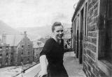
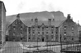
View from 'The Balconies' The view in the small picture above looks to the SE from 'The Balconies'. In the background are Holyrood Park and Salisbury Crags. The area in the middle-distance was known as 'The Big Green'. Here is another view of 'The Big Green', this one taken from the greens in front of 'The Balconies'. |
|
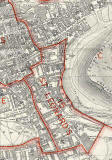
Map This part of Dumbiedykes Road was between its junctions with Waterston Avenue and Prospect Place, under the red border line at the NE corner of the St Leonard Map below. Please click on this map to enlarge it. It may be slow to load. |