|
Edinburgh Road Signs St Andrew Square |
How helpful is this Road Sign?
© peter.stubbs@edinphoto.org.uk Photograph taken: October 20, 2011
|
St Andrew Square |
|
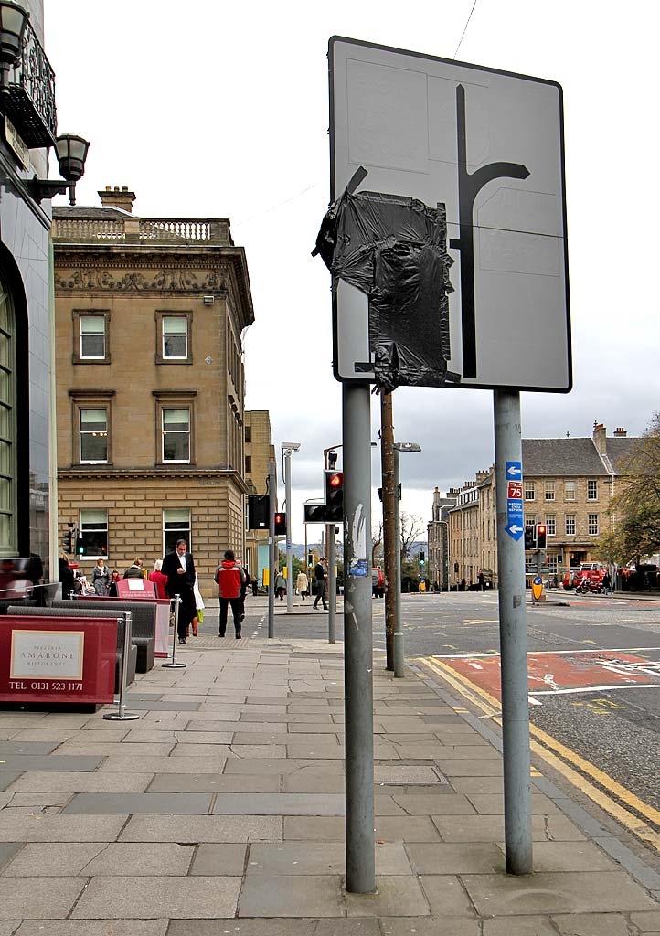
How helpful is this Road Sign? This must be one of Edinburgh's least helpful road signs. Three of the messages on the sign have been over-painted in white and the fourth message (and the road that it referred to) have been covered with black plastic sheet. This sign is in South St Andrew Street on the SW corner of St Andrew Square. The road to the left is George Street. On turning into George Street: - the former Guardian Royal Exchange building is on the left, at the corner. - Standard Life Investments building is on the right, at the corner. |
|
Traffic Flow Traffic flow around St Andrew Square has changed several times over the past few years. These changes have been brought about by the closure of Princes Street for tram works in 2009 and 2011-12. Currently, at October 2011: a) Two of the roads that used to allow traffic into and out of the square are closed to traffic. They are:
- North St Andrew Street, beside the
bus station. It used to link - South St David Street, beside Jenners. It used to link the SW corner of the square with Princes Street. a) The one-way flow of traffic around the square has been changed. There is currently a two-way flow on the west and south sides of the square, and parking in now no longer allowed along the east, west and south sides of the square. c) There used to be a restriction on traffic turning into George Street just beyond this sign. Only buses, taxis and cycles were allowed to make this turn but now all traffic is allowed to do so. The lettering on the sign that has been painted over used to refer to the restrictions in c) above. I don't know what is on the sign beneath the black plastic sheeting, or why the road on the left on the sign (George Street) has been covered up! Update January 2012 Traffic flow around St Andrew Square has changed again, at least twice since I wrote the comments in a), b), c) above. Now, the restrictions in c) have been re-imposed, but the road sign above has not changed. ie. these restrictions on the sign are still covered by a black sack! I'll not take up any more space by explaining the existing restrictions, as I expect they will probably change again soon. |
|
Cycle Route In fact the road sign above does include some useful information! On one of its posts there is a small red and blue National Cycle Network message telling cyclists on National Cycle Route 75 from Edinburgh to Gourock via Glasgow to turn left into George Street. |
|
St Andrew Square |
|
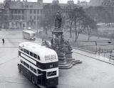
Statues In days when there was less traffic on the streets, there used to be a statue to Alexander & Bucephalus at St Andrew Square. It was in St David Street, opposite the junction with George Street, but was moved to the courtyard outside the City Chambers in the High Street in 1916. It was replaced by a large statue to Gladstone at the same position in St David Street. This statue was moved to Coates Crescent in 1953. Bus Stations Up to around the early-1960s, the sides of St Andrew Square formed a bus station for Scottish Omnibuses. There were bus stops all around the square. Then St Andrew Square bus station was build near the NE corner of the square, and parking meters (later replaced by parking ticket machines) were installed around all four sides of the square, and a one way traffic flow was introduced, clockwise around the square. The early 2000s saw further changes near the NE corner of the square: - A large Harvey Nicol store was built on the site of the former St Andrew Square Bus Station. It opened in 2002. - A new street for pedestrians and up-market shops, Multress Walk, was built immediately to the north of the Harvey Nicol store, linking St Andrew Square with the St James Centre. This was the first new street to have been built in Edinburgh's First New Town for over 200 years. - A new Edinburgh Bus Station was built immediately to the north of Multress Walk. This bus station opened in 2003. |


