|
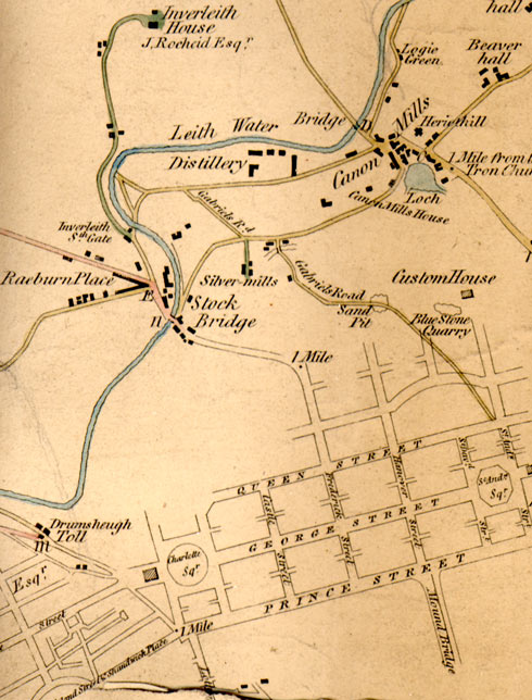
Edinburgh & Leith BOTTOM LEFT SECTION 1812 from a map showing roads within and connected to Cramond. |
© Copyright: For permission to reproduce, please contact peter.stubbs@edinphoto.org.uk
|
Map showing roads within and connected to Cramond. 1812 |
|
Here is an enlargement of the bottom left hand portion of Edinburgh & Leith section of a map surveyed in 1812. - This map shows the lay-out of Edinburgh's 'First New Town' - St Andrew Square, Charlotte Square, Princes Street, George Street, Queen Street and the roads linking them. (The 'Second New Town' was built a little further north and included the roads to the north, not yet named on the map above. - The water of Leith runs from bottom left to upper right on its way to meeting the Firth of Forth at Leith. - Inverleith House at the top of this map. The house is at the top of a small hill, now within the Royal Botanic Gardens at Inverleith. - In the centre of the map is Canonmills Loch, now drained. - The map above shows a yellow road leading from the lower right towards the centre of the map, past Sand Pit and Blue Stone Quarry. This road has now been lost under the buildings of Edinburgh's 'Second New Town'. |
|
MAPS: Full index |
|
MAPS: Short Index with thumbnails |