|
Edinburgh & Leith TOP LEFT SECTION 1812 from a map showing roads within and connected to Cramond. |
© Copyright: For permission to reproduce, please contact peter.stubbs@edinphoto.org.uk
|
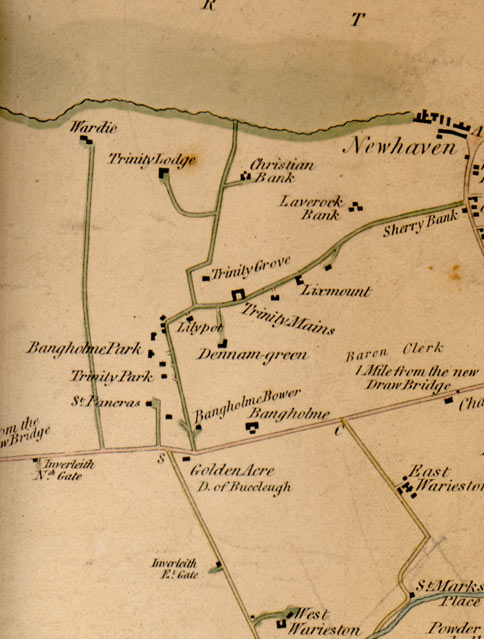
Map showing roads within and connected to Cramond. 1812 |
|
Here is an enlargement of the top left hand portion of Edinburgh & Leith section of a map surveyed in 1812. - This is an area about 1 to 2 miles to the north of Princes Street, Edinburgh. The area contained very few houses in 1812. They were mainly scattered detached houses in Trinity and terraced houses in Newhaven. - The names on the map above are still all familiar today. - The road lay-out can easily be recognised today, except for the road at the upper left leading to Wardie. The northern part of this road is now 'lost' under Wardie Primary School playing fields. The main road to the North is now Granton Road, a broad road a little further to the west, which was built to give access to the new Granton Harbour built in the 1830s. |
|
MAPS: Full index |
|
MAPS: Short Index with thumbnails |