|
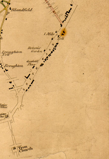
Edinburgh & Leith BOTTOM RIGHT SECTION 1812 from a map showing roads within and connected to Cramond. |
© Copyright: For permission to reproduce, please contact peter.stubbs@edinphoto.org.uk
|
Map showing roads within and connected to Cramond. 1812 |
|
Here is an enlargement of the bottom right hand portion of Edinburgh & Leith section of a map surveyed in 1812. - The main road on this map is Leith Walk, with buildings on either side as it leaves Edinburgh heading towards the Toll at Pilrig, which is about half-way to Leith. - Broughton Street leads to the north, past Broughton Toll, heading towards Blandfield and Canonmills on the left hand side of this map. - The Botanic Garden can be seen on the west side of Leith Walk. The Royal Botanic Gardens are now at Inverleith. |
|
MAPS: Full index |
|
MAPS: Short Index with thumbnails |