|
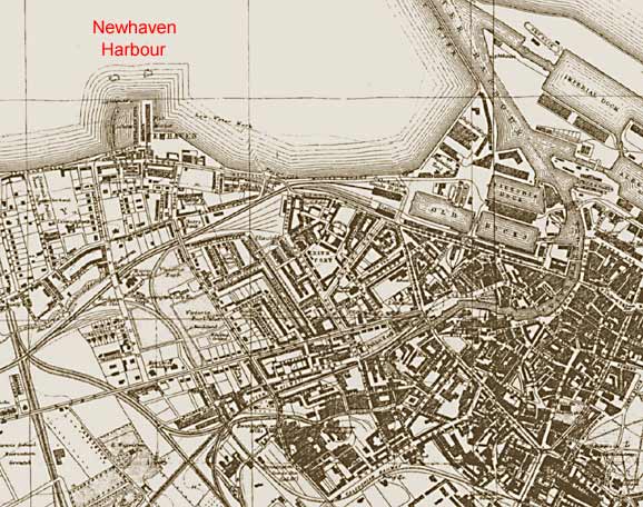
1917 This map shows how Leith expanded towards Newhaven during the 19th century. By 1917, there was industry and a complex of railway lines to the south of Newhaven Harbour, and a large built up area further east. The expansion continued throughout the 20th century, with the land between Leith Docks and the small harbour at Newhaven being reclaimed to make a far larger docks complex for Leith. The old harbour of Newhaven still exists, as does the old fishmarket immediately to the east of the harbour. Part of the fishmarket is still in operation. The remainder has been converted into: - a Newhaven Heritage Museum (which unfortunately closed in 2006) - a Harry Ramsden fish restaurant. (Now closed and replaced by a Loch Fyne Restaurant.) |
Map by James Bartholemew published in the Post Office Directory 1917-18
|
|
|
earlier map later map zoom-in zoom-out |
© For permission to reproduce, please contact peter.stubbs@edinphoto.org.uk
|
MAPS: Full index |
|
MAPS: Short Index with thumbnails |