|
Edinburgh Professional Photographers Photographs by James Pike |
|
James Pike - Outdoor Photographer I have seen only two photos by James Pike. Both are cabinet prints and are outdoor views. On the backs of these cabinet prints, James Pike gives his address as 23 Teviotdale Place, Stockbridge. Teviot Place is in The Colonies, housing built by a co-operative of workers, about a mile to the north of the centre of Edinburgh, beside the Water of Leith - not an area where a studio would normally be situated. The Colonies - Co-operative Housing I have found no mention of James Pike in the listings of photographers in the old Edinburgh Trade Directories, so perhaps he took only photographs on location. |
A group of adults with viaduct behind
Where and when was this taken?
© Reproduced with acknowledgement to David Lines
2.
A group of children with viaduct behind
Where and when was this taken?
© Reproduced with acknowledgement to David Lines
3.
The back of a James Pike cabinet print
© Reproduced with acknowledgement to David Lines
|
Question |
|
Where and when were the photos above taken? Where is the Viaduct? Below are two cabinet prints by James Pike. Both are outdoor photos, taken with fairly long exposure, judging by the movement of some of the children. Can you suggest where and when these photos might have been taken? One of the children is holding a flag. What is being commemorated? Do you recognise the viaduct in the background? If you can suggest answers to any of these questions, please email me. |
|
Answers |
||
|
Which viaduct appears in James Pike's photo? |
||
|
1. |
Archie Young |
- Newtongrange? |
|
2. |
Joe McGuigan |
- Near Hawick? - No |
|
3. |
Simon Capaldi |
- Broxburn to Newbridge? |
|
4. |
Archie Young |
- Glencorse? |
|
5. |
Bob Henderson |
- Pathhead? - Auchendinny? |
|
6. |
Bob Henderson |
- Pathhead - No |
|
7. |
Matt Rooney |
- Newtongrange? |
|
8. |
Donald Grant |
- Glencorse - No - Auchendinny? - Lasswade? |
|
9. |
Phil Wilson |
- Lasswade |
|
Of the many viaducts suggested
above for James Pike's photo, - Auchendinny |
||
|
10. |
Bob Henderson |
- Glencorse - Demolished - Auchendinny - Photos |
|
11. |
Donald Grant |
- Lasswade - No - Broxburn? - Auchendinny? |
|
12. |
Donald Grant |
- Auchendinny |
|
13. |
Bob Henderson |
- Auchendinny - No? - Finding Auchendinny Viaduct |
|
So, James Pike's photograph is not Auchendinny. The only suggestion above that still seems possible is - Broxburn However, please see below for more suggestions. |
||
|
14. |
Graeme
Kerr |
- Cumnock Templand Bridge |
|
15. |
Bob Henderson |
- Cumnock Templand Bridge - No? |
|
16. |
- Cumnock Templand Bridge - ? |
|
|
17. |
Tommy Pearson |
- Newtongrange |
|
18. |
Graham Maxwell |
- Newtongrange |
|
19. |
Tommy Pearson + additional comment by
Simon Capaldi |
- Newtongrange |
|
20. |
Tommy Pearson |
- Location - The King's Gates - Mr Pike - The Old Photo |
|
Answer 1. Archie Young Moredun, Edinburgh |
|
Thank you to Archie Young who wrote: Newtongrange? "The viaduct could be the one at the start of Newtongrange, next to the Sun Inn." Archie Young, Moredun, Edinburgh: April 4, 2009 |
|
Archie: I believe that the Newtongrange viaduct is quite a long one. The viaduct in the pictures below looks to me to be shorter, but I may be mistaken. What do others think? Peter Stubbs: April 4, 2009 |
|
I may well be mistaken. Perhaps it is Newtongrange. See Answer 17 below. August 5, 2010 |
|
Answer 2. Joe McGuigan Edinburgh |
|
Thank you to Joe McGuigan who wrote: Near Hawick? "I think that this could be Shankend Viaduct, near Hawick in the Scottish Borders. It was opened in 1862 and closed in 1969." Joe McGuigan, Edinburgh: April 5, 2009 |
|
Joe: I believe that the Shankend viaduct (like Newtongrange, above) is quite a long one. The viaduct just visible in the photo below looks to me to be much shorter. Peter Stubbs: April 5, 2009 |
|
Answer 3. Simon Capaldi Sheriffhall, Midlothian, Scotland |
|
Suggestions are now arriving at the rate of one per day! Thank you to Simon Capaldi who wrote: Between Broxburn and Newbridge? "The viaduct looks similar to that between Broxburn and Newbridge. Could it also show a bing that used to be there? " Simon Capaldi, Sheriffhall, Midlothian, Scotland: April 6, 2009 |
|
Simon: Thanks for your suggestion. However, the viaduct that you mention is a very long viaduct, across level ground. The viaduct just visible in the photo below looks to me to be much shorter. Peter Stubbs: April 6, 2009 |
|
Answer 4. Archie Young Moredun, Edinburgh |
|
Thank you to Archie Young who wrote again, as a follow-up to 1 above: Glencorse? "You could be right. Newtongrange viaduct has about 21 archways However, could it be the Glencorse viaduct that you already have on the EdinPhoto web site?" Archie Young, Moredun, Edinburgh: April 13, 2009 |
|
Thanks Archie - but even the Glencorse viaduct looks too long to me. The viaduct just visible in the photo below looks to me to be much shorter. Peter Stubbs: April 13, 2009 |
|
Answer 5. Bob Henderson Burdiehouse, Edinburgh |
|
Thank you to Bob Henderson who wrote: Pathhead? Auchendinny? "Here are another two possibilities for the viaduct. a) It could be the railway viaduct at Auchendinny. This is now part of a walkway. I'll take my camera next time I'm there. b) It could be the viaduct that carries the road to Pathhead. It can be seen if you turn right down the hill, just after you cross the bridge going into Pathhead. I have some recent photos of it, but can't find tem now. viaduct could be the one at the start of Newtongrange, next to the Sun Inn." Bob Henderson, Burdiehouse, Edinburgh: April 13, 2009 |
|
Thanks Bob. The Pathhead viaduct seems to be about the right length, but I believe that it does not have embankments at the end, as appear in the old photos. I don't know what the Auchendinny viaduct looks like. Peter Stubbs: April 13, 2009 |
|
Answer 6. Bob Henderson Burdiehouse, Edinburgh |
|
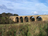
Thank you to Bob Henderson for sending me this photograph of the viaduct at Pathhead. Please click on the image to enlarge it. Bob wrote: Pathhead? - No "I've found my photo of the viaduct at Pathhead. The arches are very distinctly different from those in this photo by James Pike: So, the viaduct in James Pike's photo is not at Pathhead." Bob Henderson, Burdiehouse, Edinburgh: April 14 + 15, 2009 |
|
Answer 7. Matt Rooney Ayrshire, Scotland |
|
Thank you to Matt Rooney who wrote: Newtongrange? "What about the Viaduct leading up to Newtongrange? I sort of remember there being 'Picnic's' near to that when I was younger. There used to be a Lot of activity in that area. I remember going below the Viaduct then making for Cockpen and hame to Bonnyrigg. There was a wee dairy on the left-hand side, just before the crossroads where we turned right and made our way past Cockpen Church." Matt Rooney, Ayrshire, Scotland: April 20, 2009 |
|
Answer 8. Donald Grant Penicuik, Midlothian, Scotland |
|
Thank you to Matt Rooney who wrote: Glencorse? - No
"I've been having a look at the two photos
with the viaduct in the It is not Glencorse nor the viaduct near Newtongrange or Lothianbridge to give it its correct name." Auchendinny? "As was suggested, there is a viaduct near Auchendinny that could possibly fit the bill, but there is another lesser-known viaduct that should be considered. The Auchendinny viaduct, incidentally, is on the line that ran past Dalmore Mill, Auchendinny and through Roslin Castle Station. It is not beyond possibility that the Auchendinny and Glencorse viaducts were actually within sight of each other although they were on different branches. Lasswade? "There used to be a branch line from Polton Mills that ran alongside the North Esk and then crossed the river to the east of what is now Kevock Stables at Lasswade on a short viaduct. The line then entered a tunnel and emerged near Golf Course Road in Bonnyrigg eventually meeting the Waverley Line somewhere in the Hardengreen/Hawthornden area. The viaduct can be seen from Polton Road, Bonnyrigg. Like like the Auchendinny viaduct, the Lasswade viaduct is quite short." Donald Grant, Penicuik, Midlothian, Scotland: April 30, 2009 |
|
Answer 9. Phil Wilson Aberdeen, Scotland |
|
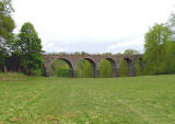
Thank you to Phil Wilson who wrote Lasswade? "After Donald's suggestion that the viaduct might be at Lasswade, I looked and found this photo on Flickr. The arches certainly look similar." Phil Wilson: May 7, 2009 |
|
I agree, Phil. The arches on the viaduct do look very similar in both photos. I think we may have found the right viaduct this time! - Peter Stubbs: May 7, 2009 |
|
Answer 10. Bob Henderson Burdiehouse, Edinburgh |
|
Thank you to Bob Henderson for telling me: Glencorse Viaduct - Demolished "Unfortunately, there will be no new photos of Glencorse Viaduct. It was demolished twenty or so years ago." |
|
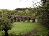
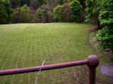
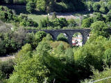
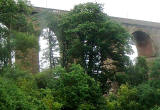
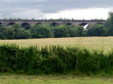
Bob added Auchendinny Viaduct - Photos "After reading Donald Grant's post about the viaducts last night, I went out to get shots of the one at Auchendinny. The topography could be made to fit the scene in the original photo, but I am still not convinced.
- Photos 1 and 2 above show the viaduct, seen from each side.
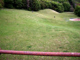
- Photos 3 and 4 above look down from the viaduct to the open grazing area on either side of the structure. These are the only open spots anywhere near to the paper mill, which was the main employer in the surrounding area. The old photo could have been of a family day out for the paper mill workers." |
|
Bob Henderson, Burdiehouse, Edinburgh: May 11, 2009 |
|
Answer 11. Donald Grant Penicuik, Midlothian, Scotland |
|
Thank you to Donald Grant who wrote Lasswade Viaduct - Photo "Here is a photograph of Lasswade viaduct that I took today. At least one span is completely obscured by the trees that have grown up around the structure." |
|
Donald wrote again after reading Phil Wilson's comments (9 above). The Pike Photo is not Lasswade Viaduct "I wish I'd seen the photo on Flickr, flagged up by Phil Wilson, before I sent my photo. The Flickr photo is much better. In any event both the Flickr photo and my photo illustrate that the viaduct in the Pike print is not Lasswade. You'll see from my photo, and from the one on Flickr, that the terrain around Lasswade viaduct is a fairly steep-sided valley. In Pike's print, there is nothing behind the viaduct above the parapet, which really rules out Lasswade." |
|
Broxburn Viaduct "Someone mentioned Broxburn and that remains a possibility. It is actually two viaducts with a short section of earthworks between them but in the meantime" |
|
Auchendinny Viaduct "I'll try to get a shot of the Auchendinny viaduct which is also still a contender although again the surrounding terrain may discount it." I've sent a message to Donald to thank him, but to let him know that I have just received Bob Henderson's photos of Auchendinny Viaduct [10 above] so it won't be necessary for Donald to take more photos of it for the web site. |
|
Donald Grant, Penicuik, Midlothian, Scotland: May 11, 2009 |
|
Answer 12. Donald Grant Penicuik, Midlothian, Scotland |
|
Thank you to Donald Grant who added: |
|
Auchendinny? "I had a go at getting to Auchendinny viaduct on Wednesday but it wasn't accessible by road. Presumably Bob went on foot. There is a major difference between the viaduct in Bob's photos and the one in the Pike photo but it doesn't rule it out. Note the distance between the apex of the arches and the top of the parapet. It's much bigger in Pike's photo, but it's possible that some of the stonework was removed over the years reducing the height of the parapet, possibly during works to open the walkway and install the fence on the viaduct. Donald Grant, Penicuik, Midlothian, Scotland: May 14, 2009 |
|
Answer 13. Bob Henderson Burdiehouse, Edinburgh |
|
Thank you to Bob Henderson who replied, making it now seem unlikely that Auchendinny Viaduct is the viaduct in the Pike photo: Bob wrote: |
|
Auchendinny Viaduct - No? "I must agree with Donald Grant about the different construction on the Auchendinny viaduct when compared to the original photo. Having walked over the Auchendinny viaduct many times, I do not think there has been any alteration to the parapet. In the shots looking down from the viaduct the tubular handrail you see is part of the original handrail. A chain-link fence has been erected inside this to protect walkers." |
|
Finding Auchendinny Viaduct "If Donald would like to see the viaduct, it is accessed by going down the old road, down to where the paper mill used to stand, then following the pathway along the side of the site and through the tunnel. This leads directly onto the viaduct." |
|
Bob Henderson, Burdiehouse, Edinburgh: May 14, 2009 |
|
Answer 14. Graeme Kerr Selkirk, Scottish Borders, Scotland |
|
Thank you to Graeme Kerr for suggesting another possible location for this viaduct. |
|
Graeme wrote: Cumnock Templand Bridge "After about a year of searching I think I have found where this photo might have been taken. The bridge to the rear of the group has 5 arches over a valley with corbelling on the uprights as the arches begin and a parapet to the outside of the main span. I believe this is the old Templand rail bridge in Cumnock. I can't provide modern images of the bridge as to the best of my knowledge it no longer exists. However, here is a link to a page that shows a 1905 photograph of Templand Rail Bridge." Graeme Kerr, October 15, 2009 |
|
Thank you to Graeme Kerr for finding this photo on Flickr. The photo is taken from the Library of Congress Collection in Washington, DC. |
|
Answer 15. Bob Henderson Burdiehouse, Edinburgh |
|
Bob Henderson replied |
|
Cumnock Templand Bridge "I have been looking at the suggestion that our railway viaduct mystery may have been solved and that it is the Templand railway bridge. To me it does not seem so. The Templand bridge spans a steep sided valley with a river in the bottom. There does not seem to be any open ground as shown in the original picture, where the works outing photograph could have been taken." Graeme Kerr, October 15, 2009 |
|
Answer 16. Bobby Grierson |
|
Thank you to Bobby Grierson who wrote: |
|
Cumnock Templand Bridge "Here is a photo of the Templand Viaduct in Cumnock, Ayrshire. The photo was taken from the Woodland Park in 2009. Cumnock Temple Bridge Zoom-in There is also another viaduct in Cumnock. It is similar but has a curve to it. I hope this goes some way towards helping you to identify the viaduct in the James Pike photo on your site." Kames Pike's photo Bobby Grierson: February 23, 2010 |
|
Answer 17. Tommy Pearson West Lothian, Scotland |
|
Thank you to Tommy Pearson for sending me comments and photographs suggesting that this is Newtongrange Viaduct. (This is the first suggestion that was made when I added the photo to the web site in April 2009. Tommy wrote: |
|
Newtongrange "I was brought up in Newtongrange. I snapped this photo on my phone. I couldn't quite get the same perspective as the original photographs as someone has unhelpfully built a housing estate just behind where they were taken from." |
|
Lothianbridge Viaduct "I reckon it's the Lothianbridge taken from near the King's Gate on the old A7, where Newbattle Abbey Crescent now is. There used to be a nine hole golf course nearby on the same piece of ground. |
|
Buildings "There was a paper mill just behind the bridge many years ago. The photos are not conclusive but I'm 60% certain it's roughly the spot where the original photos were taken. The Sun Hotel is still there and can just be seen in my photo. There were other buildings under the bridge too - there is what looks like a roof and chimneys 'under' the third arch - but most are gone now, or substantially altered. Craigesk House is still there but it would be the other side of the viaduct." |
|
Lay of the Land "I think the bridge looks shorter than it really is in the old photos because you lose sight of the southern end because of the lay of the land, the tree and the framing of the pictures. The rising ground to the left could be the steep valley side to what is known locally as the Red (Redd? - pit spoil) Woods, and of course there is a bing there now which might not have been so big when the photos were taken. That's where Newtongrange Star's football ground now is. |
|
North British Railway Bridge "My brother in law is very expert on old Scottish railways and confirms that the bridge in the old photo's is an NBR bridge. I'll probably try to photograph the bridge again in the winter when the tree cover has subsided a bit." |
|
The Old Photos "I think two of the men in the adult photo also appear in the picture with the children, so the photos are contemporaneous. Maybe it was: - a works outing? - PSA (Pleasant Sunday Afternoon club)? - Orphanage outing? The site of old Dalhousie station is nearby too. I can't remember when it closed so I can't work out whether it would still have been open when these pictures were taken." |
|
Tommy Pearson, West Lothian, Scotland: August 2, 2010 |
|
Answer 18. Graham Maxwell Kirkpatrick Fleming, Dumfriesshire, Scotland |
|
Thank you to Graham Maxwell for confirming the location identified by Tommy Pearson in 'Reply 17' above. Graham wrote: |
|
Newtongrange "I have followed this discussion with interest over the past few months, but have never been too sure as to any of the suggested places so far, until today. I completely agree with Tommy Pearson that this is the Newbattle or Lothianbridge Viaduct near Newtongrange, which I pass regularly on the A7. Although the embankment in the photographs is now covered in trees, a close examination in Google Street View seems to confirm the configuration shown in the old photos, including the fairly abrupt endings of the parapet walls. Also, I may be trying too hard, but in the adult group photograph I fancy I can see the retaining wall alongside the present-day A7 at the northern end of the viaduct over the shoulder of the man holding his hat at the right hand side of the photo. Everything about the design of the piers and arches seems a good match. More Photos "This Wikimedia Commons photo, taken from a very similar angle, does seem to to confirm that from this direction the land configuration makes the viaduct appear shorter than it really is. Here is a similar viewpoint on Google Street View from Newbattle Abbey Crescent: Even the mature clump of woodland on the right hand side of the photo seems to match well, and in the children's group photo, there may be buildings visible to the left of the clump of trees, which would correspond with the cottages still present today near the site of Dalhousie station. This woodland is marked on the 1850s OS maps so it would have been present throughout the time-period the picture must have been taken in. |
|
Graham Maxwell, Kirkpatrick Fleming, Dumfriesshire, Scotland: August 6, 2010 |
|
Answer 19. Tommy Pearson West Lothian, Scotland |
||
|
Thank you to Tommy Pearson for writing again. Tommy wrote: |
||
|
1907 "1907 is my hypothesis at the moment. See below. |
||
|
Royal Visit "This Archive web site refers to a royal visit by the Prince and Princess of Wales in that year. If they did visit Lord Lothian at Newbattle Abbey then, like George the 4th before them, they would enter the abbey through the King's Gate, next to where the photo was taken.
From previous research, I believe that the King's Gate was the 'formal' entrance to the abbey and the driveway ran down where the housing estate now is, before passing through what we now recognise as the gate to the abbey. I think that the Royal visit would explain: - the finery - the mugs around the necks of the children - the union jack - the photographer being there - why someone went to the bother of taking chairs there. (Some of the adults are sitting on them.) - the fact that they bothered gathering there at all, maybe?" |
||
|
The Date "Is that the correct year? Hmmm... I think so. but the link above also refers to other Royal visits to 'the district', Newbattle and Dalkeith 'within the last generation', which I suppose leaves open the possibility of an earlier Royal visit at some point after the viaduct was built i.e. 1847."
|
||
|
The Location "I'm 100% certain that this is the Lothian Viaduct, Lothianbridge or whatever the correct name is. The RCAHMS title it as Newbattle Viaduct. The area is Lothianbridge, which I had always thought came from the viaduct. The building visible in the third arch is Craigesk House. (It's still there in all its glory!) When I first looked at the photo I thought it was on the same side of the bridge as the photographer. It's not, it's just where it should be, on the other side, and visible through the arch, just as in my photo. In Newtongrange the viaduct is still referred to as the 'big brigs' or 'big brig'. It's just down from 'the cowps': don't ask!" |
||
|
Who are the Children? "This is much more difficult to work out. It may be: - the local schoolchildren. (Perhaps there's another picture of the headmaster, somewhere, for comparison.) - some other school. (A Royal visit would attract folk from all over the place." |
||
|
Who are the Adults? "Perhaps the oldest chap on the left of the adult photo could even be J C Carrick, himself, from Carrick House. The young lady leaning in to him in the photo looks like the identical twin of one of the kneeling ones in the front row - facially very similar and baith wearing the same bunnets. A couple of the chaps are wearing medals or badges on watch chains. That might have been common practise on high days and holidays. I've got pictures of my grandfather from around that time wearing a similar chain (football medals). I expect that the photographer man would have taken more than two photos on that occasion." |
||
|
Tommy Pearson, West Lothian, Scotland: August 10, 2010 |
|
Answer 20. Tommy Pearson West Lothian, Scotland |
||
|
Tommy Pearson provided more information to clarify the points he made earlier. Tommy wrote: |
||
|
Location "The Kings Gate associated with Newbattle Abbey, and near the viaduct, is the one just 400 yards or so north of the viaduct on the A7. It can be seen on this Google Map.
|
||
|
The King's Gates "This Kings Gate is the one referred to in John Prebble's 'The King's Jaunt' about George IV's visit to Scotland, specifically in relation to his visit to Newbattle Abbey. The other King's Gate mentioned is one of the gates to Dalkeith Palace, on the A68, just near Sheriffhall roundabout, and near the Flavian fort at Elginhaugh. Both George and Victoria (1842, maybe) stayed at Dalkeith Palace because of the poor state of Holyrood. |
||
|
Tommy has been doing further research on the web and sent me information on a possible Royal visits by: - Victoria to Newbattle in 1886 - Edward VII and Alexandra to Edinburgh in 1903 - George V to Edinburgh in 1911. Tommy added: |
||
|
Mr Pike "I'm still inclined to think that the photo was taken in 1907, but based on no more than intuition. I believe we need some other piece of information to nail this.. e.g. when Mr Pike was active? I'm guessing he was a professional photographer, because of the printing on the back of the pictures and because he crammed a lot of people into the photos, perhaps hoping to sell lots of them." |
||
|
The Old Photo "Why did Mr Pike use the viaduct as a backdrop and why is the one of the children so off centre? A couple of the children in the photo are holding books or papers. Can you make out with a magnifying glass whether there's any print/writing visible? ** Finally, for the moment, there are one or two little features of the photo that I can't work out.. The photo looks as if it's been touched up or modified in some way. I've seen other old photo's where details have been enhanced or apparently touched up with a pencil. It's no great matter, but odd." |
||
|
** Unfortunately, nothing more can be seen on the photo. - Peter Stubbs, |
|
Outdoor Photographs by James Pike |
|
|
Where and When? More photos |


