|
Talk to Broughton History Society - Monday 9 February 2015 Introduction |
|||||
|
1 |
2 |
3 |
4 |
5 |
6 |
|
7 |
8 |
9 |
10 |
11 |
12 |


|
Broughton Maps Broughton 1804
|
|
Maps and
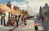
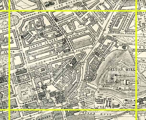
Aerial View 1844 Map showing Edinburgh New Town expanding to the east to include Broughton.
1925 Map showing the street layout very much as we know it today.
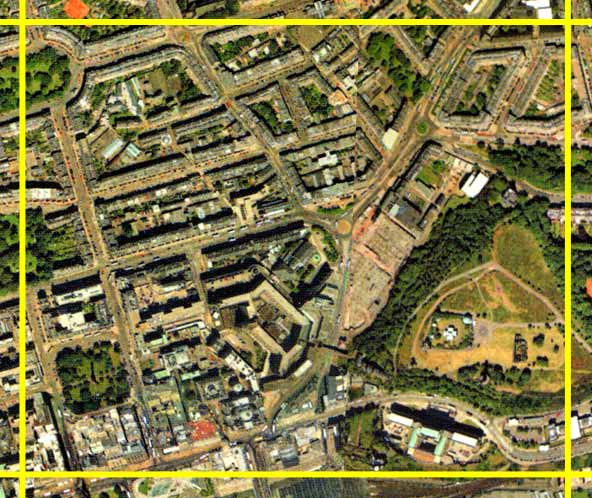
© Peter Stubbs Please contact peter.stubbs@edinphoto.org.uk for permission to reproduce 2001 Aerial View with still a lot of trees to be seen in and around the area.
© Copyright: XYZ Digital Map Company Limited. Click here for details of web site.
|
|
|||||||||

|
Maps and Observations Maps from 1955 1931 1906 1894 1877 1837 1804
each showing the Edinburgh Council Area |
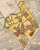
1955 Map
OS 1:10560 scale
(This is the most recent large scale OS map that I've been able to reproduce without obtaining a licence from Ordnance Survey and paying copyright fees to them.)
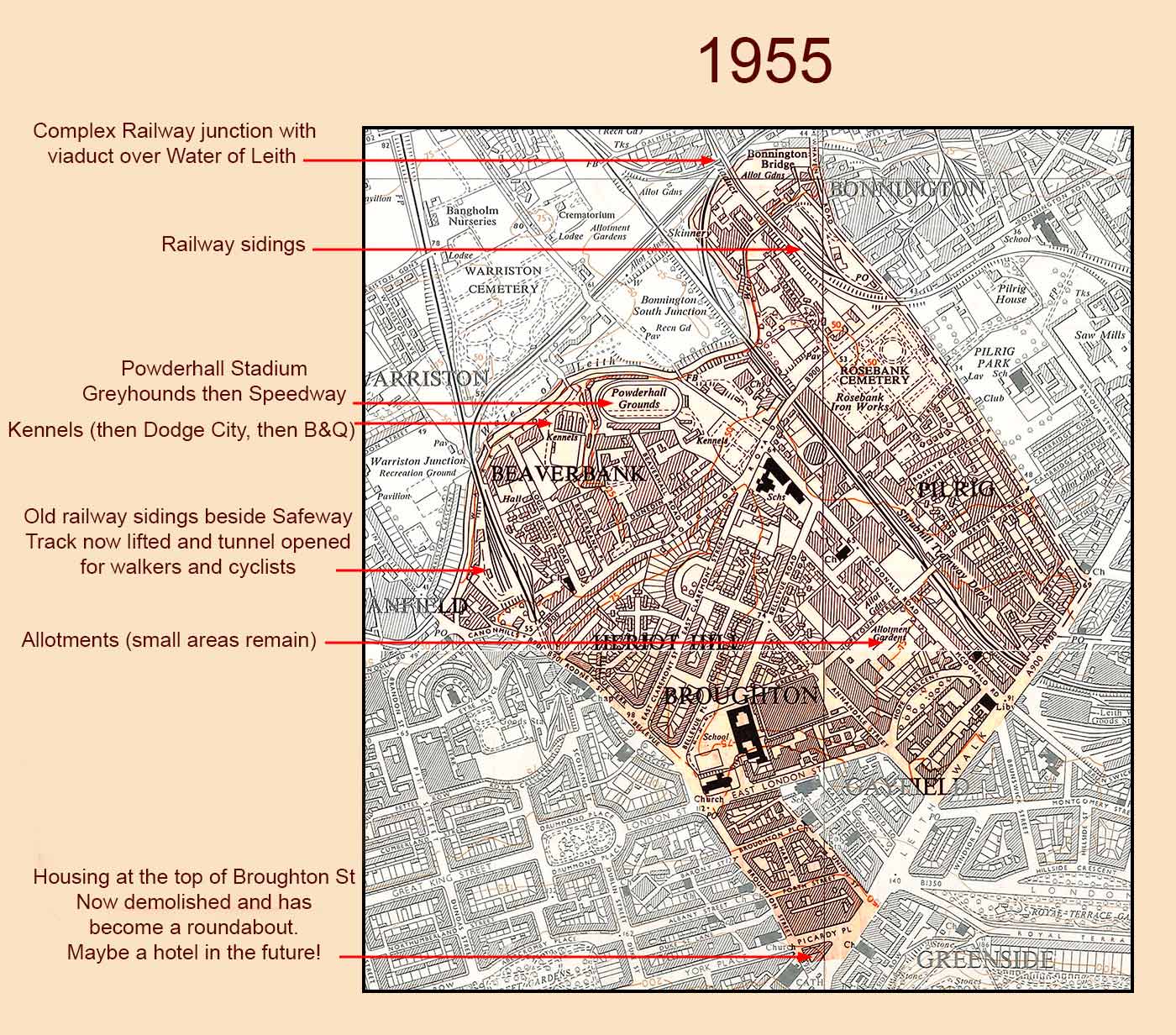 © peter.stubbs@edinphoto.org.uk with acknowledgement to the National Library of Scotland for providing a copy of the map used above
|
|
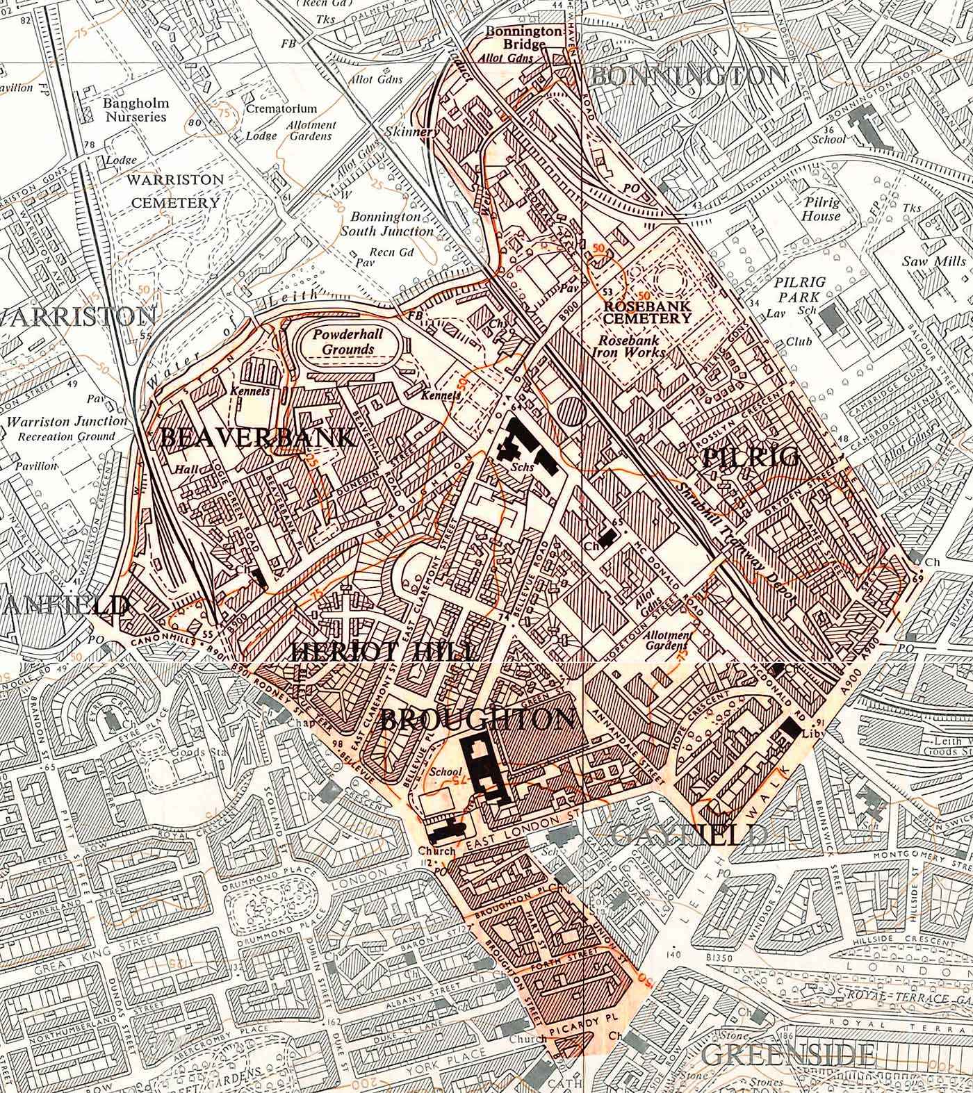
Zoom-in on the 1955 Map © peter.stubbs@edinphoto.org.uk with acknowledgement to the National Library of Scotland for providing a copy of the map used above |
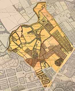
1931 Map
OS 6 inch scale
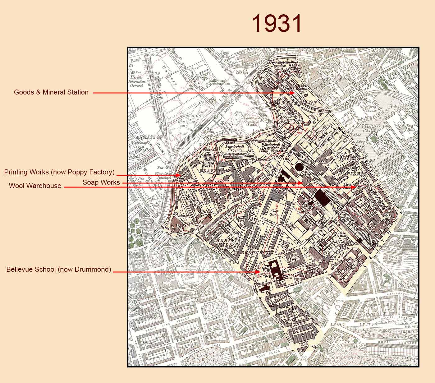 © peter.stubbs@edinphoto.org.uk with acknowledgement to the National Library of Scotland for providing a copy of the map used above
|
|
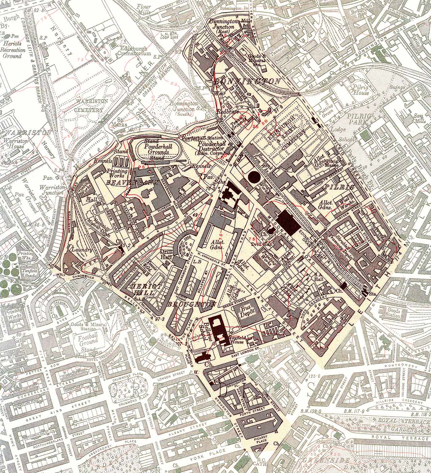
Zoom-in on the 1931 Map © peter.stubbs@edinphoto.org.uk with acknowledgement to the National Library of Scotland for providing a copy of the map used above |
1906 Map
OS 6 inch scale
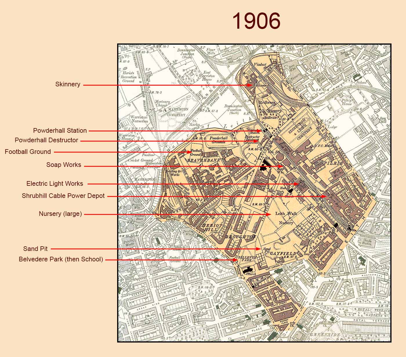 © peter.stubbs@edinphoto.org.uk with acknowledgement to the National Library of Scotland for providing a copy of the map used above
|
|
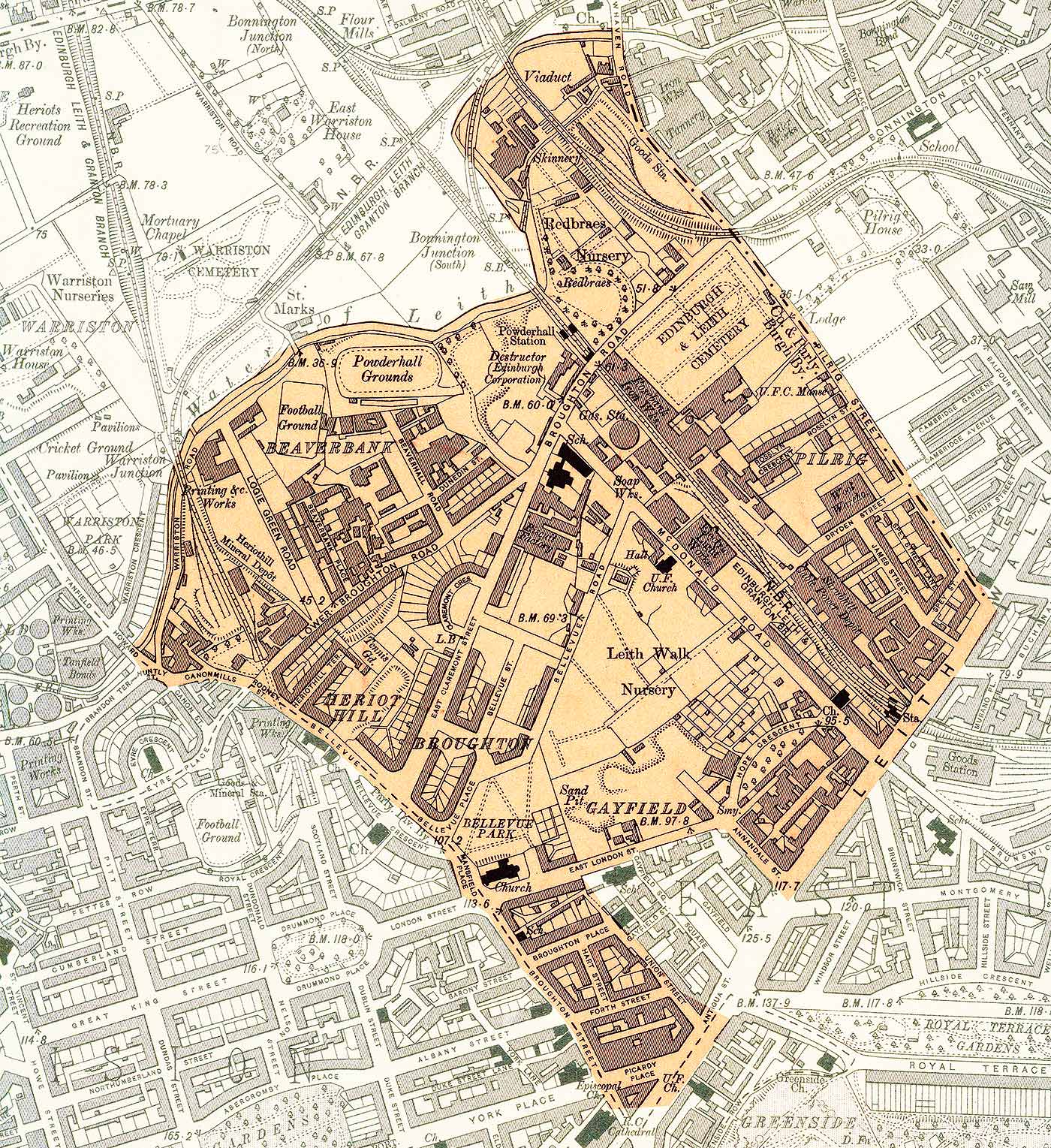
Zoom-in on the 1906 Map © peter.stubbs@edinphoto.org.uk with acknowledgement to the National Library of Scotland for providing a copy of the map used above |
1894 Map
OS 6 inch scale
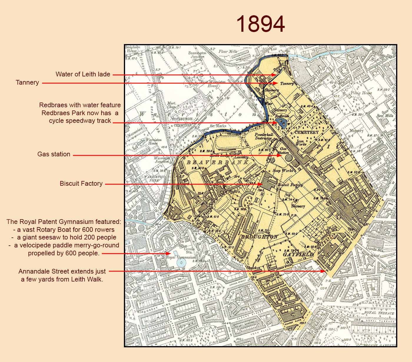 © peter.stubbs@edinphoto.org.uk with acknowledgement to the National Library of Scotland for providing a copy of the map used above
|
|
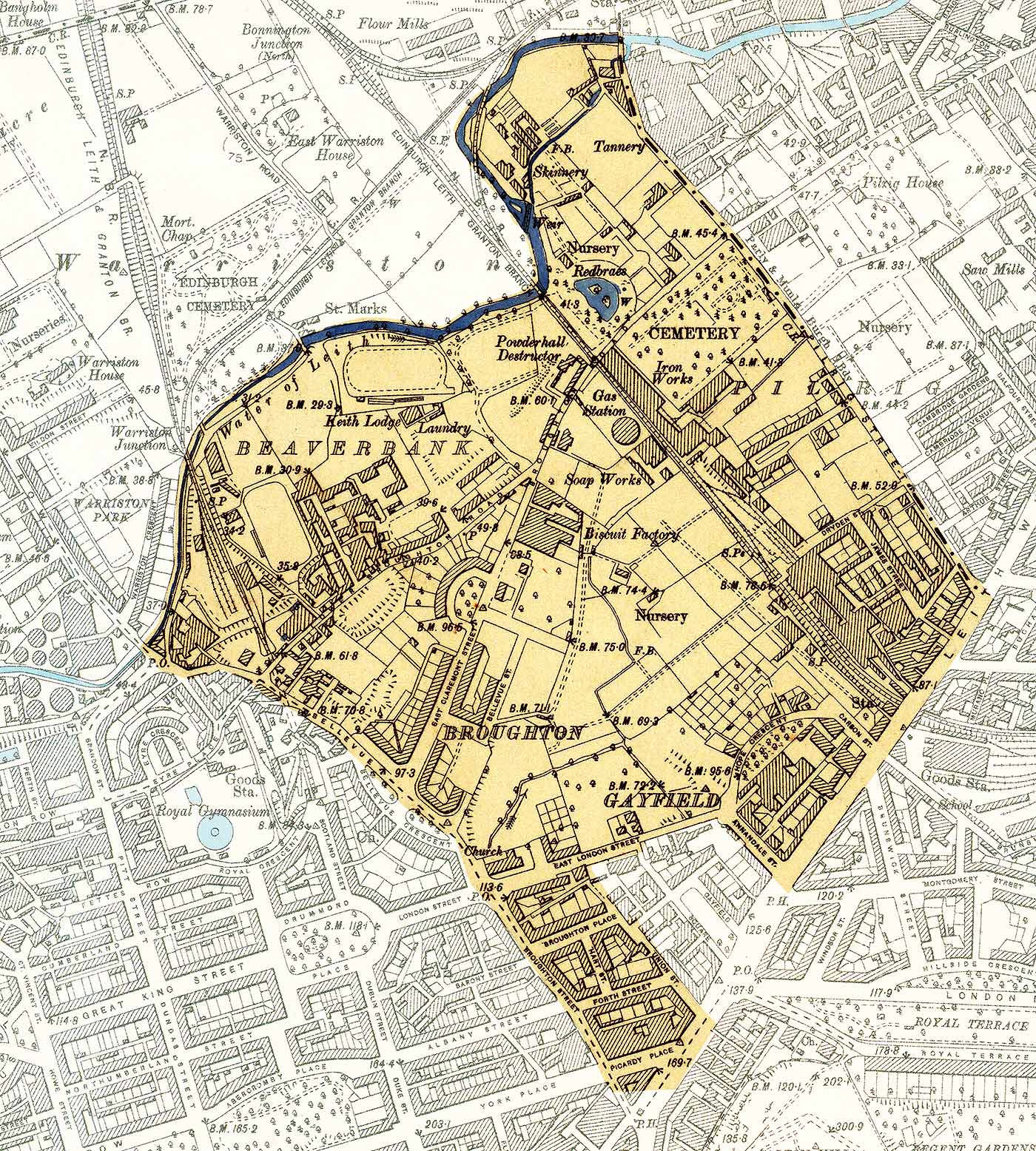
Zoom-in on the 1894 Map © peter.stubbs@edinphoto.org.uk with acknowledgement to the National Library of Scotland for providing a copy of the map used above |
1877 Map
OS 6 inch scale
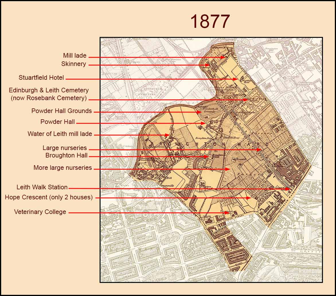 © peter.stubbs@edinphoto.org.uk with acknowledgement to the National Library of Scotland for providing a copy of the map used above
|
|
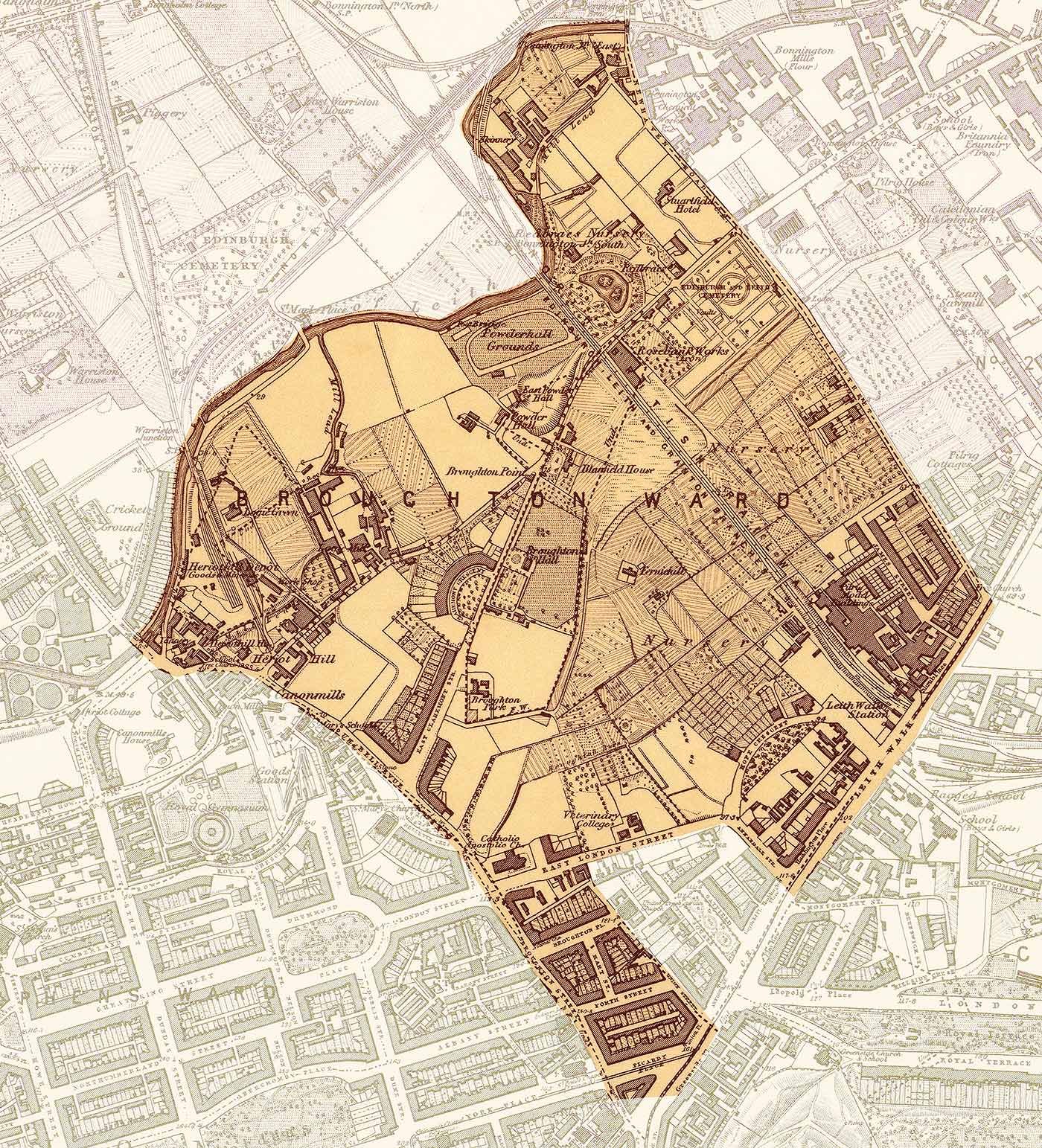
Zoom-in on the 1877 Map © peter.stubbs@edinphoto.org.uk with acknowledgement to the National Library of Scotland for providing a copy of the map used above |
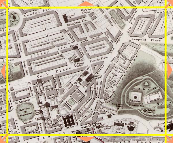
1837 Map
Stevenson
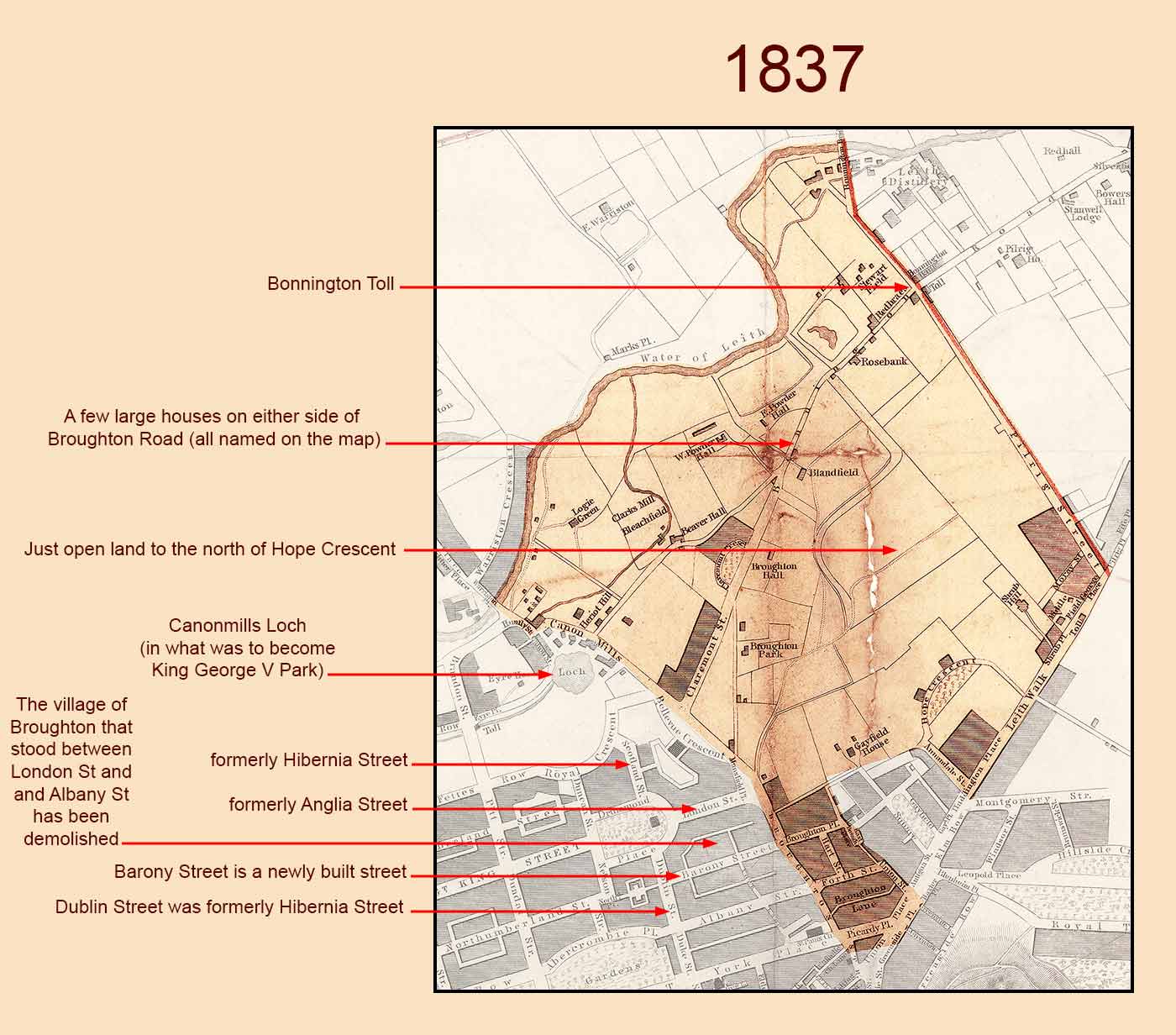 © peter.stubbs@edinphoto.org.uk with acknowledgement to the National Library of Scotland for providing a copy of the map used above
|
|
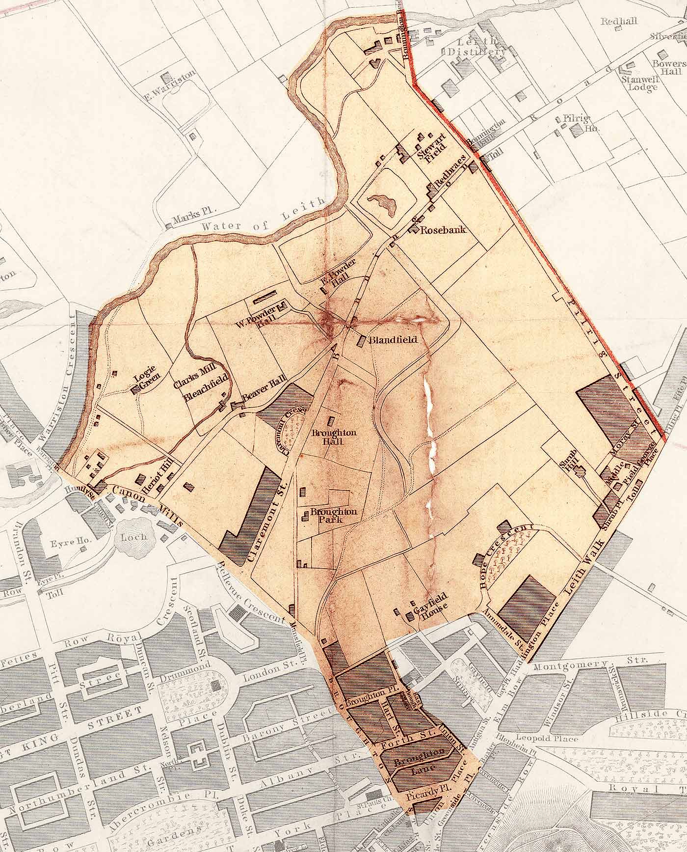
Zoom-in on the 1837 Map © peter.stubbs@edinphoto.org.uk with acknowledgement to the National Library of Scotland for providing a copy of the map used above |
1804 Map
Ainslie
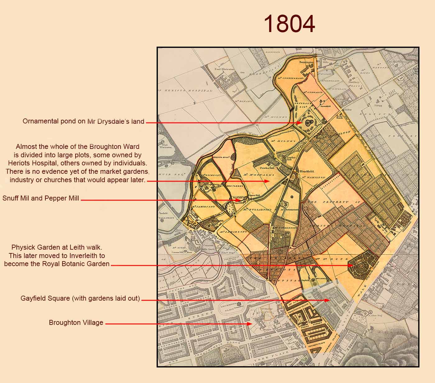 © peter.stubbs@edinphoto.org.uk with acknowledgement to the National Library of Scotland for providing a copy of the map used above
|
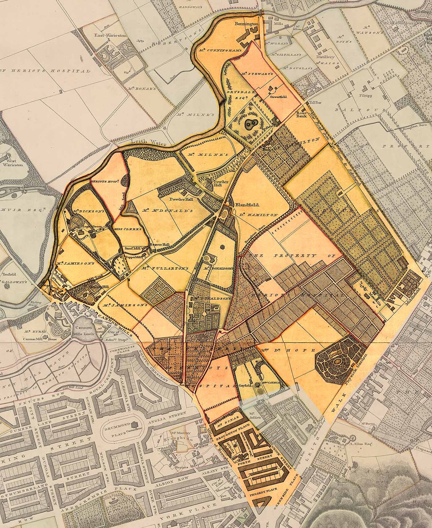
|
Zoom-in on the 1804 Map © peter.stubbs@edinphoto.org.uk with acknowledgement to the National Library of Scotland for providing a copy of the map used above |
End of Page 6
|
Talk to Broughton History Society - Monday 9 February 2015 Introduction |
|||||
|
1 |
2 |
3 |
4 |
5 |
6 |
|
7 |
8 |
9 |
10 |
11 |
12 |