Old Town - Houses and Streets
Please keep scrolling down this page.
|
Museum of Edinburgh Talk PAGE INDEX
The History of Edinburgh Old Town & Royal Mile in Pictures |
||
|
0. |
Lots of photos to see. |
|
|
1. |
Talbot, Daguerre, Hill & Adamson, Engravings. |
|
|
2. |
Edinburgh Calotype Club |
|
|
3. |
Dumbiedykes, |
|
|
4. |
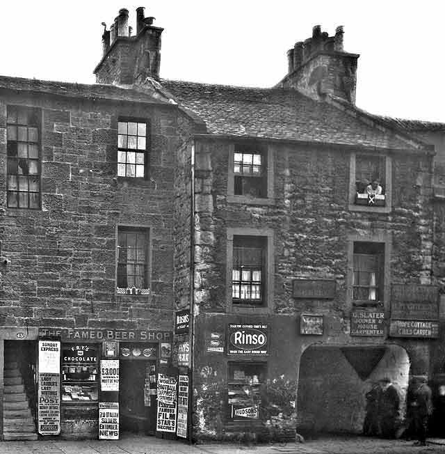
Shops, Shops and Cars, |
|
|
5. |
Festivals and Processions, |
|
|
6. |
Castle to Palace |
|
|
7. |
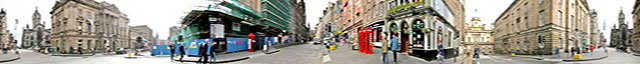
Royal Mile. |
|
|
Edinburgh Old Town Streets and Houses |
|
Dumbiedykes - St Leonard's |
|
Recollections |
|
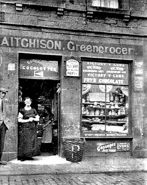
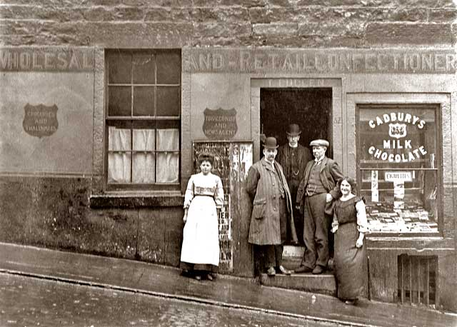
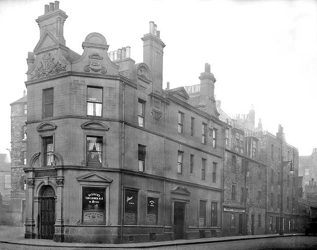
Southside Since creating the EdinPhoto web site, I have received emails from many of the people who grew up in Edinburgh and are now scattered around the world. Those who grew up in some of the poorer areas of the Old Town have very fond memories of their early years, despite the hardship that they had to cope with. They usually refer to their homes as being in 'Southside', rather than the 'Old Town'. Here are some of the photos that have been discussed in these recollections: |
1.
|
DUMBIEDYKES |
|
Dumbiedykes |
||
|
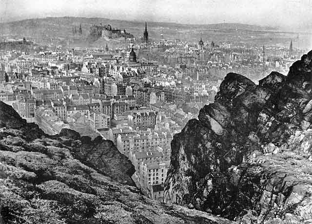
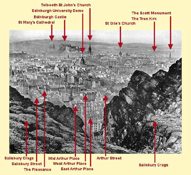
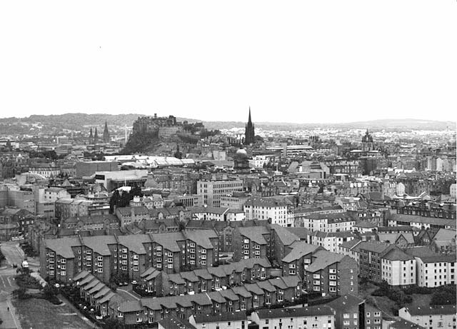
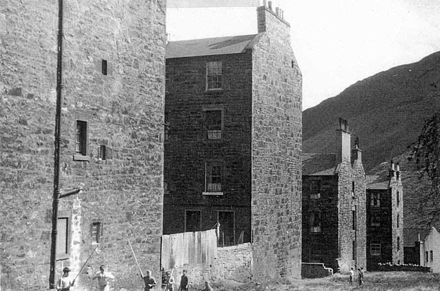
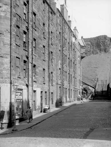
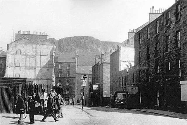
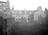
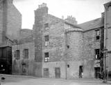
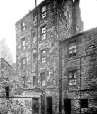
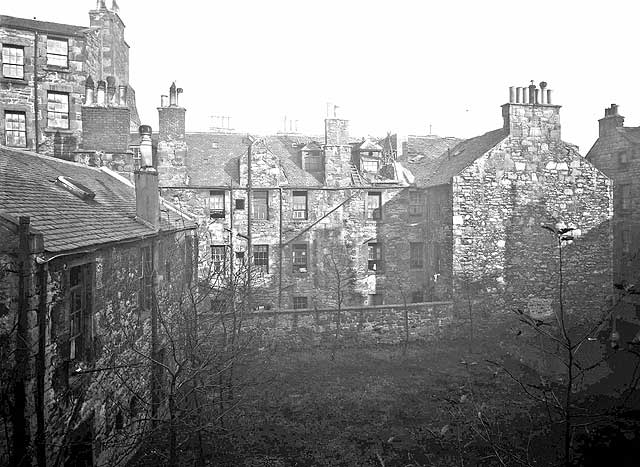
Houses in the Dumbiedykes district, that lies between Pleasance and Holyrood Park, were demolished in the 1960s and replaced by modern flats. Here are some views looking down on the district from Salisbury Crags in Holyrood Park: ________________________________________________________________ Around 1940 Looking down on Dumbiedykes and across to Edinburgh Castle
© Reproduced by courtesy of Evening News. Click here for web site details
© Reproduced by courtesy of Evening News. Click here for web site details.
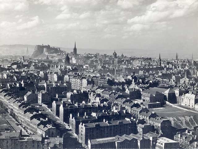
Around 1950 Looking down on Dumbiedykes and across to Edinburgh Castle
© Reproduced with acknowledgement to Norward Inglis and his daughter, Barbara Simpson Around 1995 The same view as above, but taken 45 years later with the newer housing in the foreground
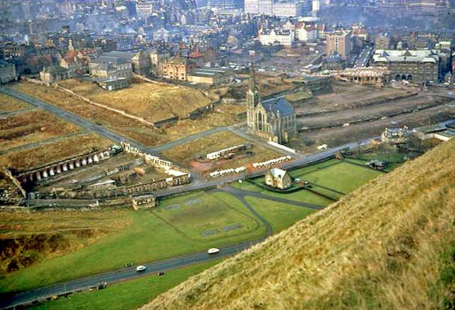
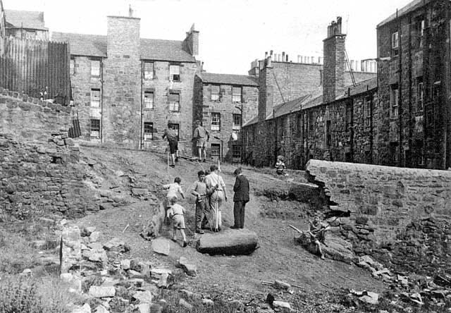
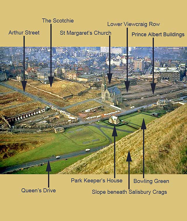
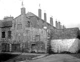
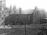
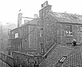
Around mid-1960s View from beneath Salisbury Crags Dumbiedykes, following demolition, with only the church still standing
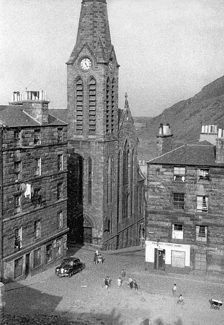
© Wullie Croal. Thank you, also, to Tam Croal (Wullie's son) for providing this photo Here is another photo of the church, taken in the days when it was still surrounded by houses: 1959 Prospect Place +Prospect Terrace
©
Reproduced with acknowledgement to Edinburgh City Libraries and
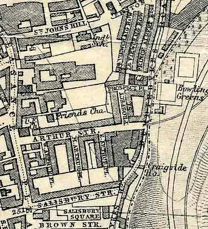
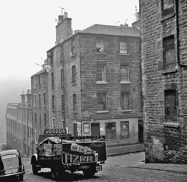
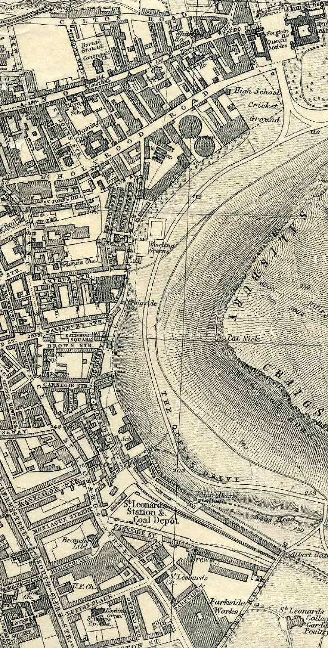
Information Services ________________________________________________________________ Arthur Street Arthur Street ran through the middle of Dumbiedykes, leading from Pleasance down to Holyrood Park. There was a gentle slope near the top of the hill, becoming steeper as the street approached Holyrood Park. Map of Dumbiedykes
© For permission to reproduce please contact peter.stubbs@edinphoto.org.uk Three streets ran to the south from Arthur Street. They were: - West Arthur Place - Middle Arthur Place - East Arthur Place These were know locally as 'Westie', 'Middlie' and 'Eastie' This is the new housing that can be found today where the top of Arthur once stood, looking down from Pleasance towards Holyrood Place. New Arthur Place
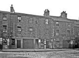
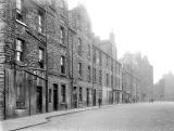
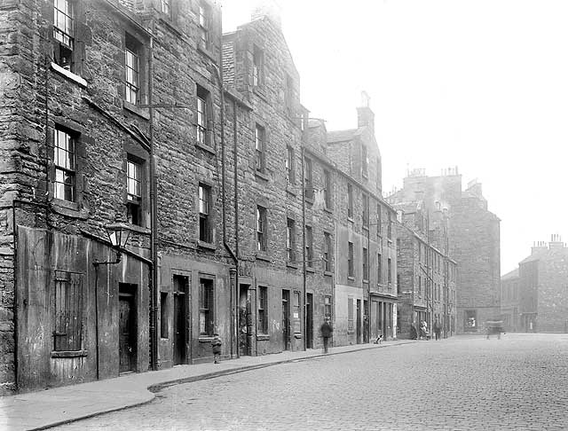
© Peter Stubbs: Please contact peter.stubbs@edinphoto.org.uk Photo taken: December 22, 2007 Here's what the area looked like early in the 20th century ... Arthur Street - c.1914
Arthur Street - early-1920s
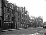
© Reproduced with acknowledgement to John Smith, Paisley, Renfrewshire, Scotland. ... and here it is in the mid-20th century, shortly before demolition: Looking up Arthur Street - 1959
© Reproduced with acknowledgement to Edinburgh City Libraries and Information Services Neg. F936C Looking down Arthur Street to the junction with East Arthur Place - 1960s
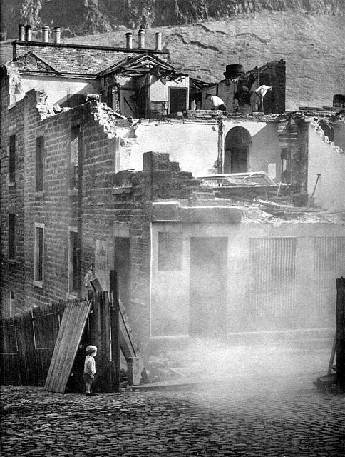
Here are the buildings on the corner of Arthur Street being demolished a few years later: The corner of Arthur Street and East Arthur Place
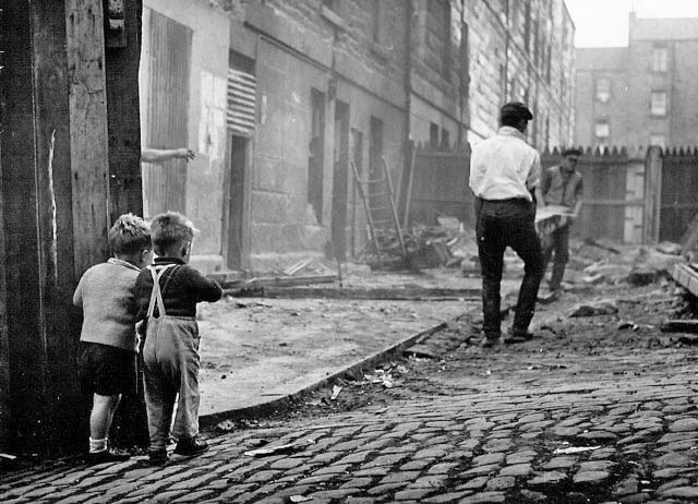
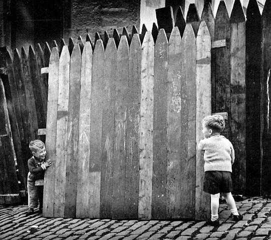
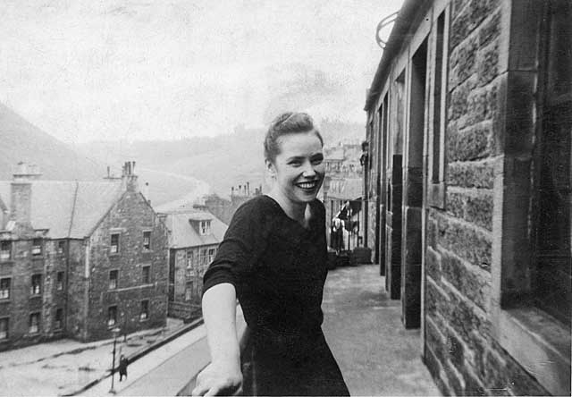
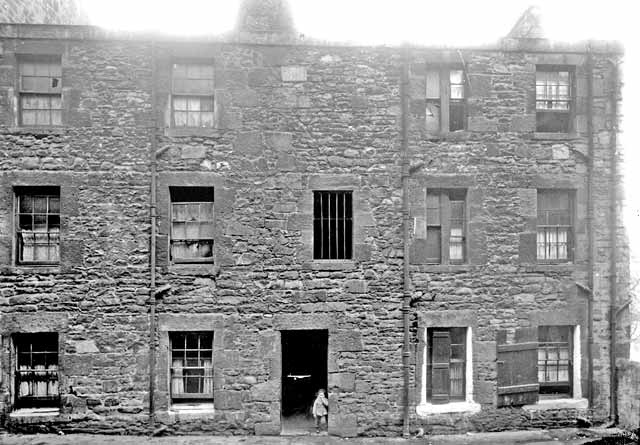
© Photograph reproduced with acknowledgement to Allan Dodds, Nottingham, England East Arthur Place Two Children + Two Workers
© Allan Dodds, Nottingham, Nottinghamshire, England East Arthur Place Two Children (again)
© Allan Dodds, Nottingham, Nottinghamshire, England Here is the southern end of the three streets 'Eastie', 'Middlie' and 'Westie' That's the end furthest from Arthur Street. Part of the slope of Arthur's Seat in Holyrood Park can be seen in the background. East, Middle and West Arthur Place - 1959
© Reproduced with acknowledgement to Edinburgh City Libraries and Information Services Neg. E932B These two views look along one of the three Arthur Place streets towards Arthur Street: Arthur Place - 1959
© Reproduced with acknowledgement to Edinburgh City Libraries and Information Services Neg. E932C Arthur Place - 1959
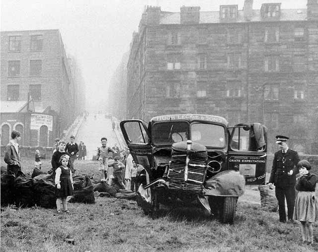
© Reproduced with acknowledgement to Edinburgh City Libraries and Information Services Neg. E932F This is the coal lorry that ran out of control down Arthur Street and into Holyrood Park in 1958. Leckie's Coal Lorry that ran out of control down Arthur Street and into Holyrood Park
© Reproduced with acknowledgement to Ron Leckie, California, USA
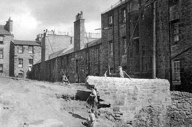
________________________________________________________________ The Scotchie The Scotchie was the level raised area of open land in Dumbiedykes. Arthur Street and 'The Scotchie' can also be seen on the left of this photo: Looking down on Dumbiedykes following demolition Only the church is still standing
© Wullie Croal. Thank you, also, to Tam Croal (Wullie's son) for providing this photo. Key added by Peter Stubbs Several people have sent me their memories of 'The Scotchie'. Here are some of their comments.
________________________________________________________________ Dumbiedykes Road This is the road at the foot of Dumbiedykes which ran alongside Holyrood Park. Dumbiedykes Road - 1959
© Reproduced with acknowledgement to Edinburgh City Libraries and Information Services [Ref S1014F] ... and a few photos from people who lived in or near Dumbiedykes Road:
Pat Ramage
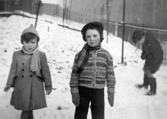
© Reproduced with acknowledgement to Jean Rae, who lived at 34 Dumbiedykes Road until its demolition in the 1960s Elizabeth Bottomley and Jean Aithie in the snow outside outside No 42, Dumbiedykes Road
© Reproduced with acknowledgement to Jean Rae, who lived at 34 Dumbiedykes Road until its demolition in the 1960s from William Waugh Ltd, Metal Merchants - late-1950s Waugh's yard used to be in the Southside before moving to Granton.
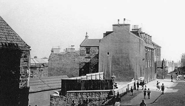
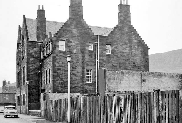
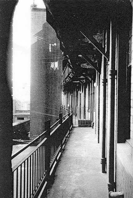
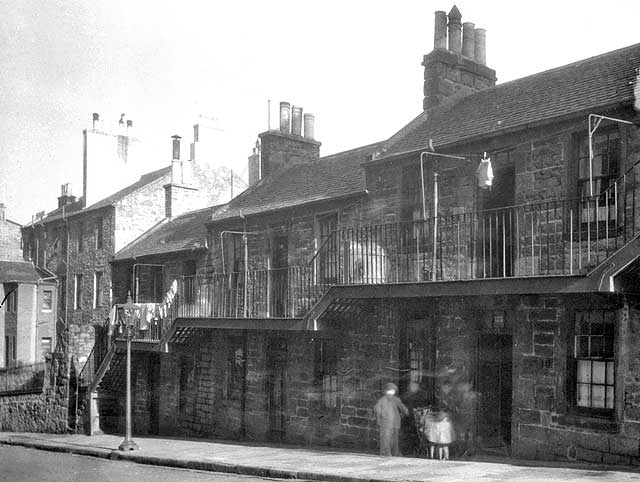
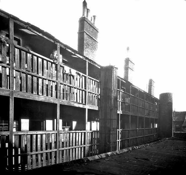
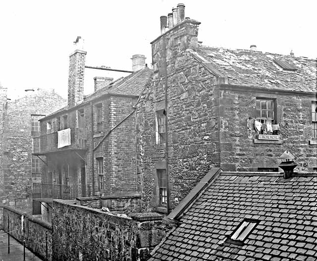
© Reproduced with acknowledgement to Jean Rae, daughter of Tom Aithie on the left of this picture ________________________________________________________________ St Patrick's School St John's Hill I'm pleased to say that after looking for several years to meet a request for a photo of St Patrick's RC school at St John's Hill, to be added to the EdinPhoto web site, two turned up together. Please scroll down to see these two photos, followed by two photos of the housing with balconies at St John's Square St John's Hill - 1959
© Reproduced with acknowledgement to Edinburgh City Libraries and Information Services Neg. C919F St John's Hill - 1960s
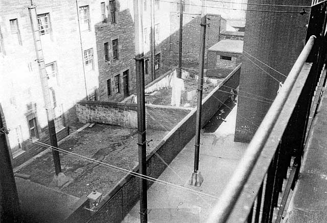
© Jack Gillon, Edinburgh Photo taken 1960s St John's Square, looking east - 1959
©
Reproduced with acknowledgement to Edinburgh City Libraries and
Information Services St John's Square - 1959
© Reproduced with acknowledgement to Edinburgh City Libraries and Information Services Neg. C914D |

2.
|
ST. LEONARD'S |
|
St Leonard's |
||||||||||||||||||||||||||||||||||||||||||||||||
|
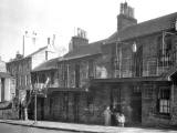
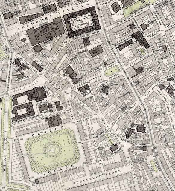
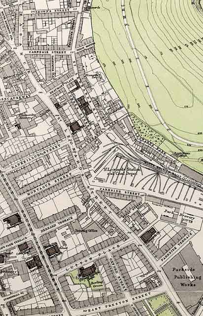
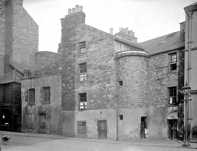
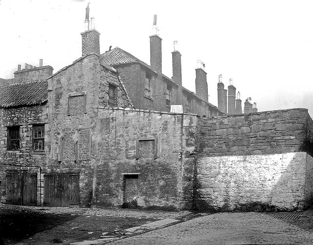
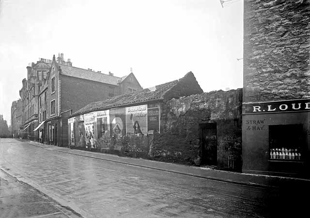
ST Leonard's district lies to the south of Dumbiedykes. It also lies next to Holyrood Park, and at one time included St Leonard's Brewery and the old railway sidings and engine shed. St Leonard's district is in the lower portion of this map. Incidentally, the top of this map also shows the old industries including the breweries and gasometers that were once at Holyrood. Holyrood (top): Dumbiedykes (centre): St Leonard's (bottom)
©
For permission to reproduce, please contact
peter.stubbs.
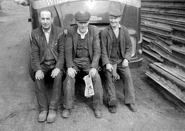
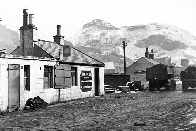
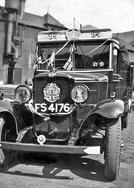
This is an extract from a map of Edinburgh & Leith by Leckie's Coal Lorries It was one of Leckie's coal lorries that ran out of control down Arthur Street. Here are a couple mor of the company's lorries in the coal yard at St Leonard's. - A snow-covered Arthur's Seat is in the background of the first photo. - The lorry in the second photo has been decorated to commemorate the Coronation of King George VI in 1937.
Another Lorry belonging to the Hugh Leckie
& Sons.
© Reproduced with acknowledgement to Ron Leckie, California, USA
Another Lorry belonging to the Hugh Leckie
& Sons.
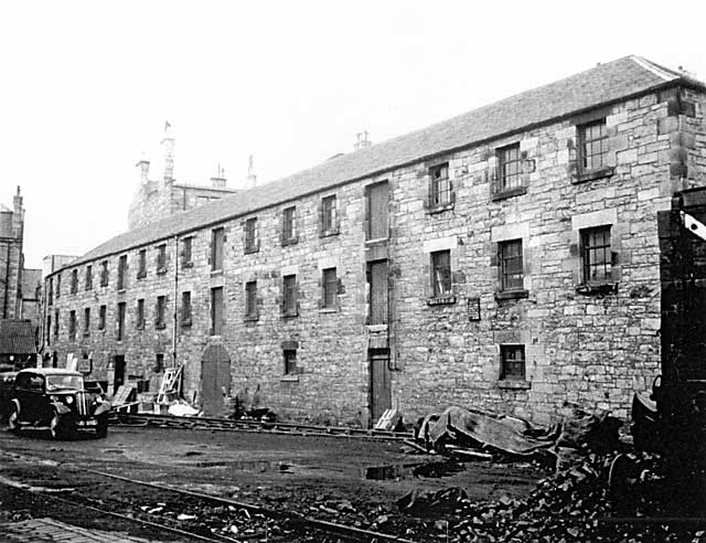
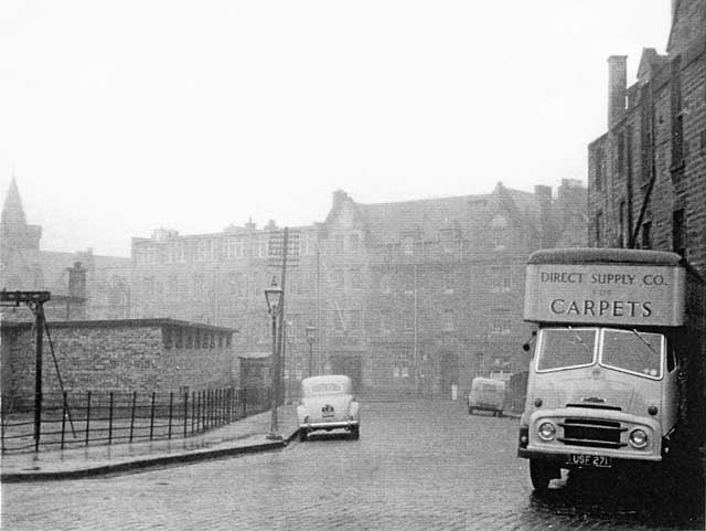
© Reproduced with acknowledgement to Ron Leckie, California, USA Here is another photo taken in what used to be the railway yard at St Leonard's. This building has now been converted into a vegetarian restaurant named 'The Engine Shed'. St Leonard's Sidings - 1959
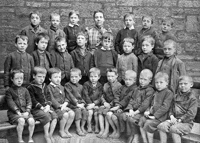
© Reproduced with acknowledgement to Edinburgh City Libraries and Information Services [Ref R1010B] It was Ron Leckie, son of the owner of the 'Hugh Leckie & Sons' coal merchants' business who sent me the photos of the coal lorries above. He also sent me a photo of this local school class of barefoot children that included his father: Milton Street School - Around 1895
© Reproduced with acknowledgement to Ron Leckie, California, USA
Milton Street School - Around 1895
© Reproduced with acknowledgement to Ron Leckie, California, USA
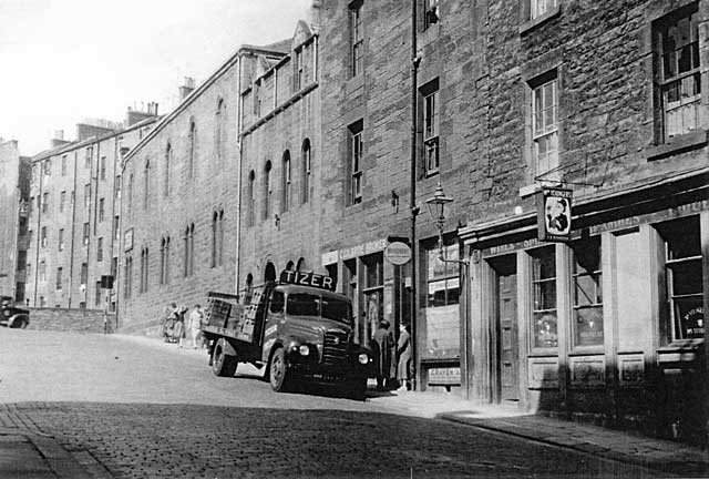
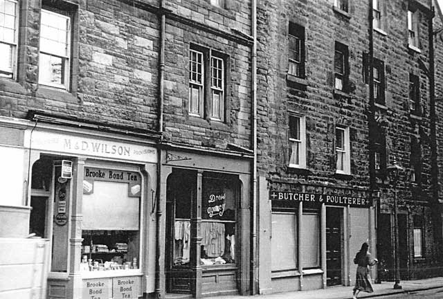
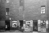
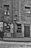
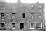
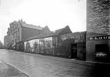
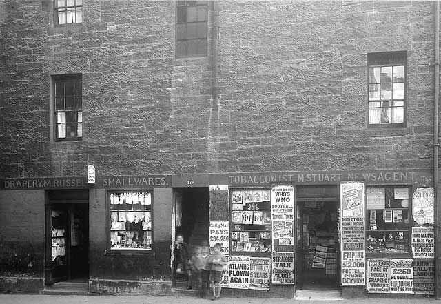
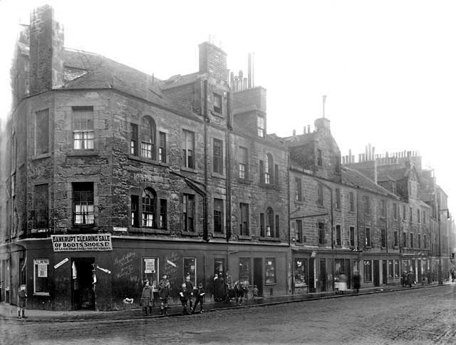
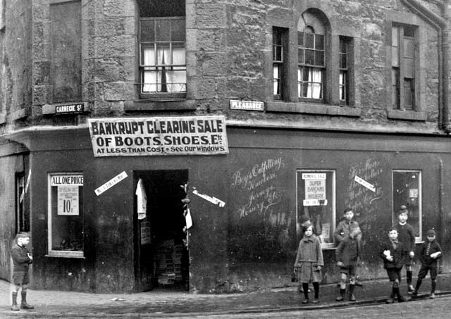
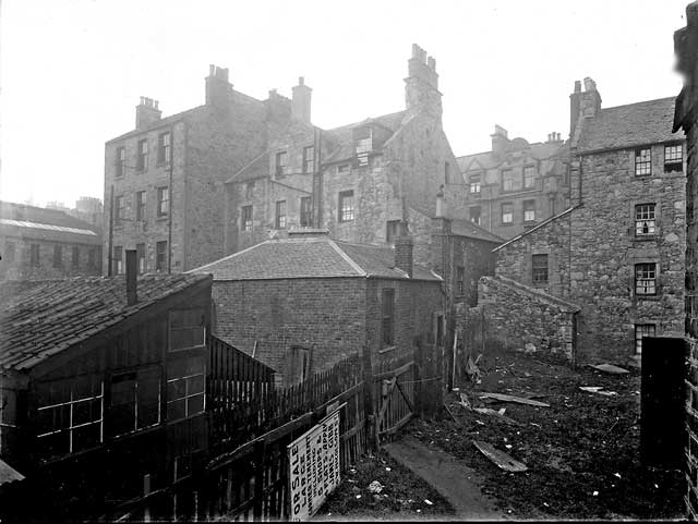
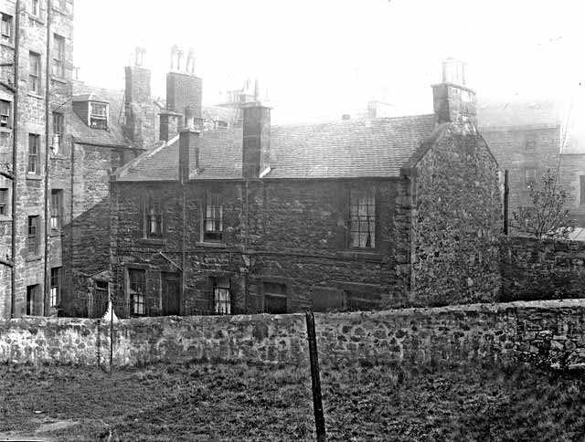
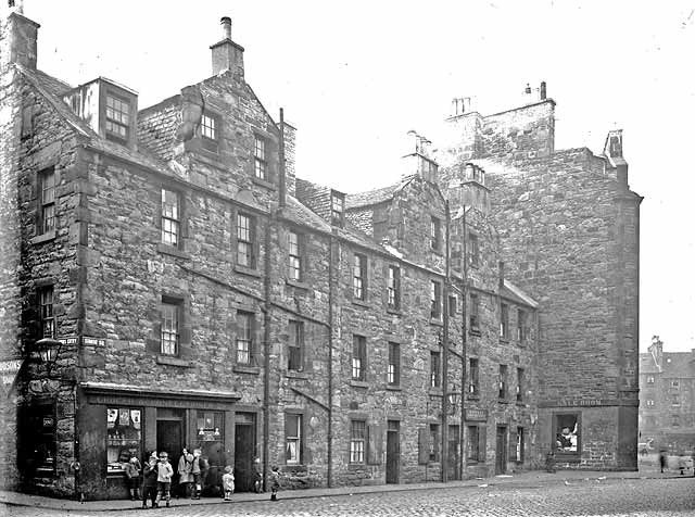
___________________________________ Carnegie Street Exterior and Interior Views Carnegie Street West end of the street- 1959
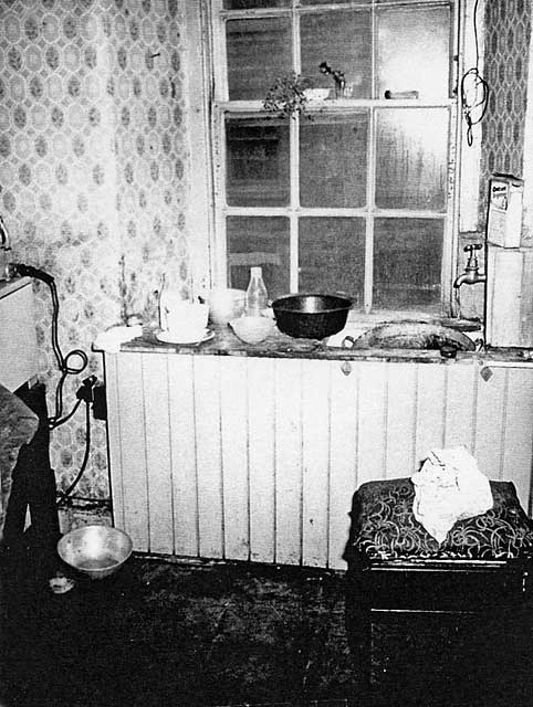
© Reproduced with acknowledgement to Edinburgh City Libraries and Information Services Neg. D924D Inside No.35 Carnegie Street - 1959
Inside No.35 Carnegie Street - 1959
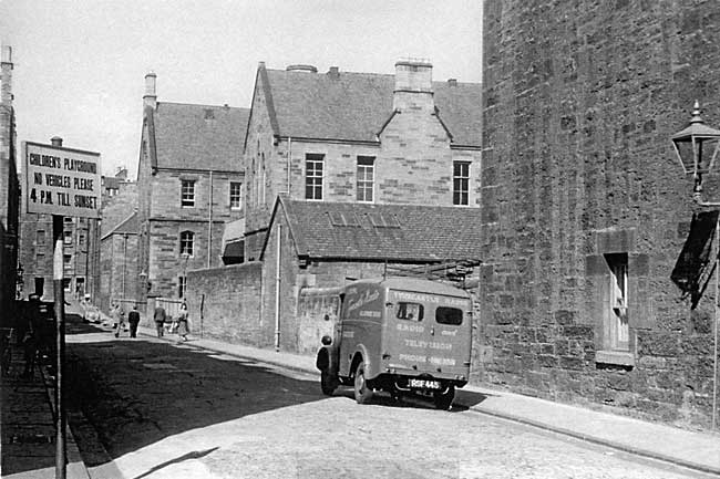
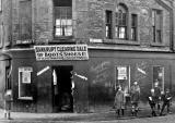
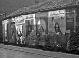
© Reproduced with acknowledgement to Edinburgh City Libraries and Information Services Neg. P997A ___________________________________ Forbes Street It looks as if there would have been no problem in finding a parking space in Dumbiedykes or St Leonard's in the 1950s. Here are a few photos of vehicles in Forbes Street, close to St Leonard's school. Forbes Street - 1959
© Reproduced with acknowledgement to Edinburgh City Libraries and Information Services Neg. G939A Forbes Street - 1959
©
Reproduced with acknowledgement to Edinburgh City Libraries and
Information Services
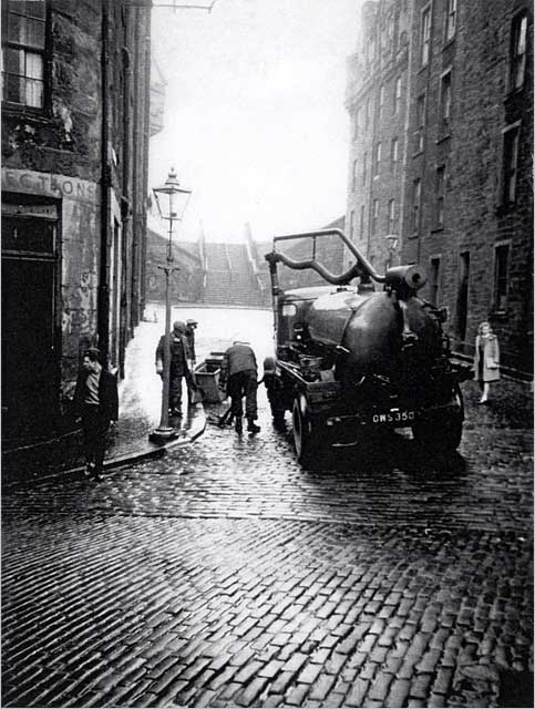
© Photo taken by Wullie Croal and reproduced with acknowledgement also to his son, Tam Croal. ___________________________________ Heriot Mount A short street with steps leading into Holyrood Park Clearing the Drains in Heriot Mount - 1959
©
Reproduced with acknowledgement to Edinburgh City Libraries and
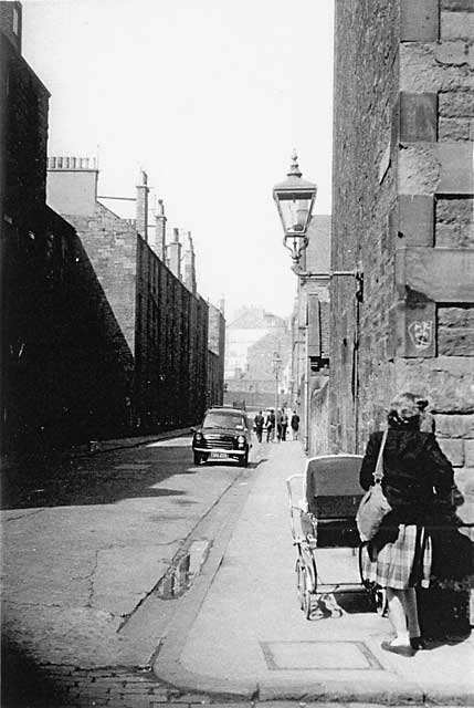
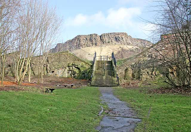
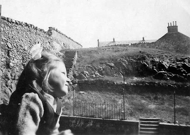
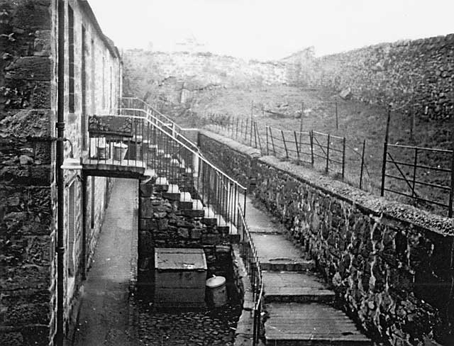
Information Services Looking down Heriot Mount to the steps into Holyrood Park - 1959
©
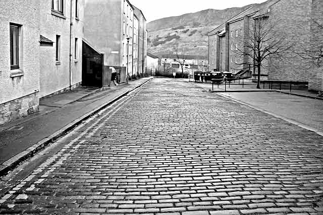
Reproduced with acknowledgement to Michael Lindsay and to Here is the same view taken in 2008. The houses have gone. The steps and crags are still there.
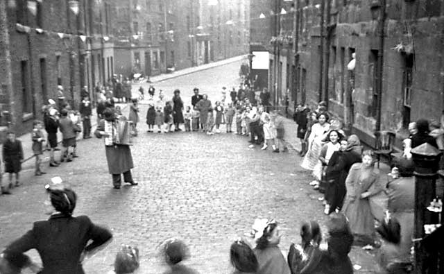
© Peter Stubbs peter.stubbs@edinphoto.org.uk Photo taken: February 26, 2008 ___________________________________ ___________________________________ Heriot Mount continued Street Party - Coronation, 1953
© Photo taken by Wullie Croal and reproduced with acknowledgement also to his son, Tam Croal.
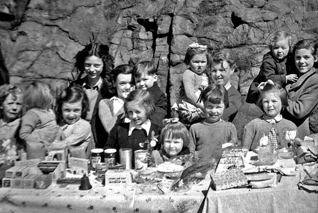
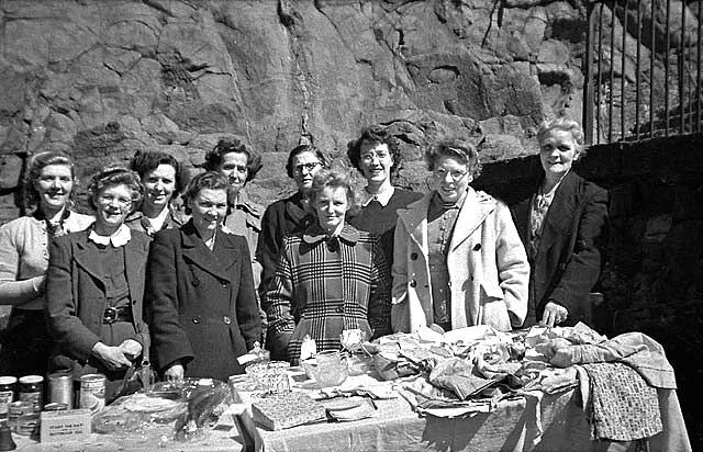
Children at a 'Bring & Buy' Sale What was the occasion?
© Wullie Croal. Thank you, also, to Tam Croal (Wullie's son) for providing this photo Adults at the 'Bring & Buy' Sale What was the occasion?
© Wullie Croal. Thank you, also, to Tam Croal (Wullie's son) for providing this photo View from the Back Window of No 6 Heriot Mount - Around 1950
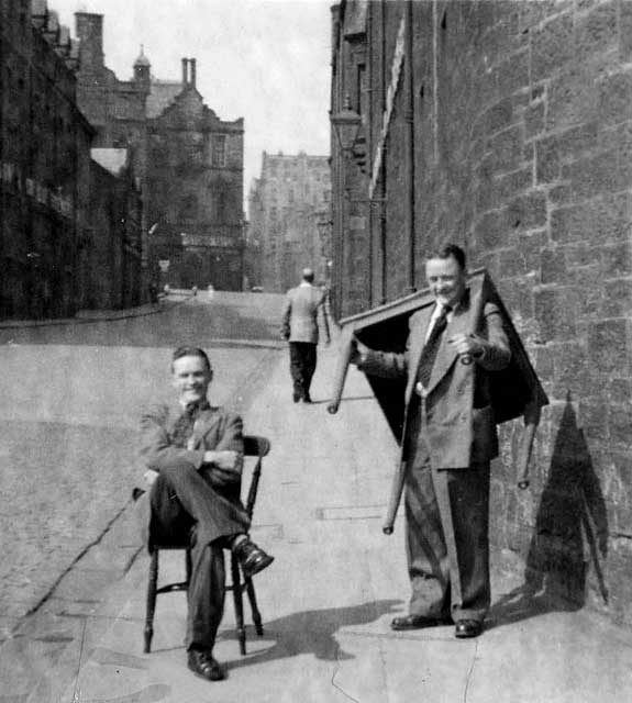
© Photograph reproduced with acknowledgement to Tam and Wullie Croal A Few Photos by Wullie Croal Several of the photos above were taken by Wullie Croal and enlarged in his darkroom at home, using an enlarger built from an old condensed milk tin and other parts. They were sent to me by Wullie's son, Tam. Here is a photo of Wullie and his brother taken in Holyrood Road, while they were moving house and transporting all the furniture by hand! Wullie and Robert Croal - Holyrood Road - 1950s
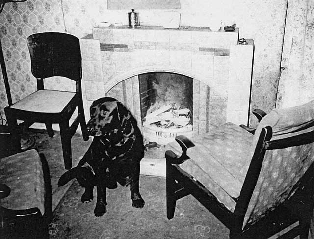
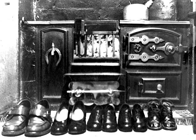
© Photograph reproduced with acknowledgement to Tam and Wullie Croal Recollections Fireplace Here is a photo that Tam Croal sent me, of the fireplace at the home of his father, Wullie Croal. The photo was taken by Wullie. I was pleased to receive a few emails about this photo after adding it to the EdinPhoto web site:
© Wullie Croal. Thank you to Tam Croal (Wullie's son) for sending this photograph to me.
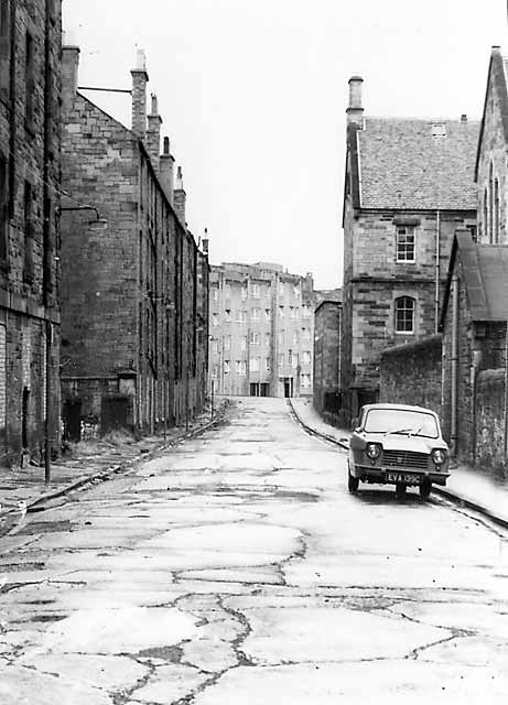
This section ends with a few more photos of streets in Dumbiedykes, some taken in 1959, others taken in the 1920s. 1959 1. Beaumont Place
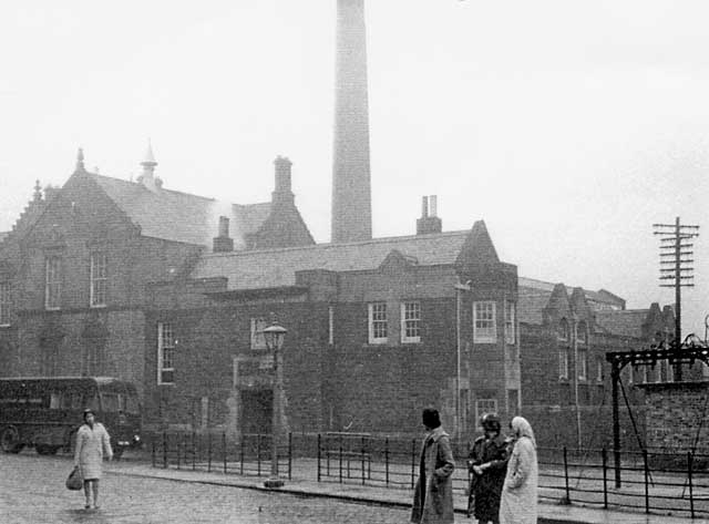
© Reproduced with acknowledgement to Edinburgh City Libraries and Information Services Neg. G943A 2. Deaconess Hospital, Pleasance
© Reproduced with acknowledgement to Edinburgh City Libraries and Information Services Neg. L973D 3. St Leonard's Terrace
© Reproduced with acknowledgement to Edinburgh City Libraries and Information Services Neg. R1008C 4. Public Wash House, Simon Square
© Reproduced with acknowledgement to Edinburgh City Libraries and Information Services Neg. L973C
|
||||||||||||||||||||||||||||||||||||||||||||||||
|
1920s "Where is it?"
western side of area
Bartholemew map revised 1891, based on Ordnance Survey maps surveyed 1876-77 © Reproduced by permission of the Trustees of the National Library of Scotland. eastern side of area
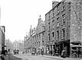
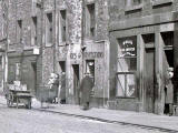
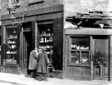
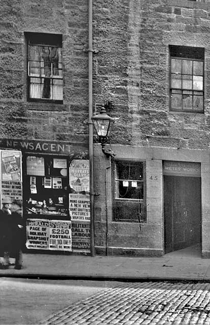
1. 1920s East Crosscauseway
© Reproduced with acknowledgement to David Gordon, Old Town, Edinburgh 2. 1920s South Richmond Street
© Reproduced with acknowledgement to David Gordon, Old Town, Edinburgh 3. 1920s Richmond Lane
© Reproduced with acknowledgement to David Gordon, Old Town, Edinburgh 4. 1920s South Richmond Street
© Reproduced with acknowledgement to David Gordon, Old Town, Edinburgh 5. 1920s Simon Square
© Reproduced with acknowledgement to David Gordon, Old Town, Edinburgh 6. 1920s Pleasance
© Reproduced with acknowledgement to David Gordon, Old Town, Edinburgh 7. 1920s South Richmond Street
© Reproduced with acknowledgement to David Gordon, Old Town, Edinburgh 8. 1920s East Crosscauseway
© Reproduced with acknowledgement to David Gordon, Old Town, Edinburgh 9. 1920s Rear of Carnegie Street
© Reproduced with acknowledgement to David Gordon, Old Town, Edinburgh 10. 1920s Dumbiedykes Road
© Reproduced with acknowledgement to David Gordon, Old Town, Edinburgh 11. 1920s Cowan's Close
© Reproduced with acknowledgement to David Gordon, Old Town, Edinburgh 12. 1920s East Crosscauseway
© Reproduced with acknowledgement to David Gordon, Old Town, Edinburgh zoom-in (left)
© Reproduced with acknowledgement to David Gordon, Old Town, Edinburgh zoom-in (right)
© Reproduced with acknowledgement to David Gordon, Old Town, Edinburgh 13. 1920s Between St Patrick's Street and Cowan's Close
© Reproduced with acknowledgement to David Gordon, Old Town, Edinburgh 14. 1920s Pleasance
© Reproduced with acknowledgement to David Gordon, Old Town, Edinburgh zoom-in (left)
© Reproduced with acknowledgement to David Gordon, Old Town, Edinburgh zoom-in (right)
© Reproduced with acknowledgement to David Gordon, Old Town, Edinburgh 15. 1920s Pleasance
© Reproduced with acknowledgement to David Gordon, Old Town, Edinburgh zoom-in (left)
© Reproduced with acknowledgement to David Gordon, Old Town, Edinburgh 16. 1920s East Crosscauseway
© Reproduced with acknowledgement to David Gordon, Old Town, Edinburgh 17. 1920s Simon Square
© Reproduced with acknowledgement to David Gordon, Old Town, Edinburgh 18. 1920s Simon Square
© Reproduced with acknowledgement to David Gordon, Old Town, Edinburgh 19. 1920s Where is it?
© Reproduced with acknowledgement to David Gordon, Old Town, Edinburgh 20. 1920s Hardwell Close
© Reproduced with acknowledgement to David Gordon, Old Town, Edinburgh 21. 1920s Simon Square and Gibb's Entry
© Reproduced with acknowledgement to David Gordon, Old Town, Edinburgh 22. 1920s Pleasance
© Reproduced with acknowledgement to David Gordon, Old Town, Edinburgh zoom-in (left)
© Reproduced with acknowledgement to David Gordon, Old Town, Edinburgh zoom-in (centre
© Reproduced with acknowledgement to David Gordon, Old Town, Edinburgh zoom-in (right)
© Reproduced with acknowledgement to David Gordon, Old Town, Edinburgh 23. 1920s East Crosscauseway
© Reproduced with acknowledgement to David Gordon, Old Town, Edinburgh zoom-in (right)
© Reproduced with acknowledgement to David Gordon, Old Town, Edinburgh
|
||||||||||||||||||||||||||||||||||||||||||||||||


End of Page 3
|
Museum of Edinburgh Talk PAGE INDEX |
||
|
0. |
Lots of photos to see. |
|
|
1. |
Talbot, Daguerre, Hill & Adamson, Engravings. |
|
|
2. |
Edinburgh Calotype Club |
|
|
3. |
Dumbiedykes, |
|
|
4. |
Shops, Shops and Cars, |
|
|
5. |
Festivals and Processions, |
|
|
6. |
Castle to Palace |
|
|
7. |
Royal Mile. |
|
|
Peter Stubbs, Edinburgh |
||